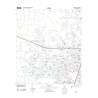
2012 Map of Slidell
USGS Topo · Published 2012About this map
Slidell serves as the focal point of this St. Tammany Parish study, showing the city's complex suburban layout as it meets the wetlands of the Lake Pontchartrain basin. The landscape is defined by the winding paths of Bayou Bonfouca, Bayou Vincent, and Liberty Bayou, which dictate the placement of numerous residential developments and golf courses. Notable family and community landmarks such as Kenjockety Farm and the Dixie Ranch Lookout Tower sit on the northern periphery, while the central area is densely populated with neighborhood clusters like Ozone Woods, Slidell Manor, and Huntwyck Village.
Find a feature on this map
216 named features on this map. Tap any name to fly to it.
Don’t see what you’re looking for? This feature index may not catch every label — zoom into the map to look around manually.
Map Details
Editions of this 2012 Slidell Map
This is the sole edition of this map. No revisions or reprints were ever made.
Other maps of this area

1892 · Chef Menteur
USGS Topo · 1:62,500

1893 · Rigolets
USGS Topo · 1:62,500

1914 · Nicholson
USGS Topo · 1:62,500

1921 · Nicholson
USGS Topo · 1:62,500

1935 · Slidell
USGS Topo · 1:62,500

1936 · North Shore
USGS Topo · 1:31,680

1936 · South Point
USGS Topo · 1:31,680

1936 · Chef Menteur
USGS Topo · 1:62,500

1936 · Rigolets
USGS Topo · 1:62,500

1939 · Slidell
USGS Topo · 1:62,500