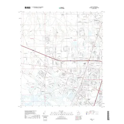
2018 Map of Slidell
USGS Topo · Published 2018About this map
Slidell is the focal point of this St. Tammany Parish study, showing the city's complex network of waterways and evolving infrastructure. The landscape is defined by its relation to the Pearl River, which courses along the eastern boundary, and a system of bayous including Bayou Bonfouca, Bayou Vincent, and Bayou Paquet. The map highlights the city's historical growth with several established cemeteries such as Greenwood Cem and Oddfellow Cem, alongside the Southeast Louisiana Veterans Cem near the Slidell Airport. To the south and west, the smaller communities of Bonfouca, Colt, and McClane City are visible near the intricate wetlands surrounding Liberty Bayou. Northward, the settlements of Maude, Amos, and Saint Joe illustrate the area's development outside the primary urban center. The survey documents the dense residential street grids and commercial corridors that have come to characterize this coastal Louisiana region.
Find a feature on this map
310 named features on this map. Tap any name to fly to it.
Don’t see what you’re looking for? This feature index may not catch every label — zoom into the map to look around manually.
Map Details
Editions of this 2018 Slidell Map
This is the sole edition of this map. No revisions or reprints were ever made.
Other maps of this area

1892 · Chef Menteur
USGS Topo · 1:62,500

1893 · Rigolets
USGS Topo · 1:62,500

1914 · Nicholson
USGS Topo · 1:62,500

1921 · Nicholson
USGS Topo · 1:62,500

1935 · Slidell
USGS Topo · 1:62,500

1936 · North Shore
USGS Topo · 1:31,680

1936 · South Point
USGS Topo · 1:31,680

1936 · Chef Menteur
USGS Topo · 1:62,500

1936 · Rigolets
USGS Topo · 1:62,500

1939 · Slidell
USGS Topo · 1:62,500