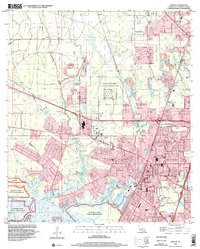
1998 Map of Slidell
USGS Topo · Published 2002About this map
Slidell occupies a transition from the developing residential street grids of North Slidell and McClane City to the protected wetlands of the Big Branch Marsh National Wildlife Refuge. The map captures a moment when traditional maritime and rail infrastructure, such as the Old Railroad Grade and the winding Bayou Bonfouca, defined the town's geography alongside modern institutional expansions like Memorial Hospital and the Slidell Airport. For genealogists, the landscape is punctuated by a high density of burial sites including Greenwood Cem, Oddfellow Cem, and the Forest Lawn Cem Mausoleum. Military and civic activity is anchored by Camp Villere and the City Hall complex, while smaller outlying settlements such as Alton and St Joe maintain their distinct identities near the Pearl River bottomlands.
Find a feature on this map
60 named features on this map. Tap any name to fly to it.
Don’t see what you’re looking for? This feature index may not catch every label — zoom into the map to look around manually.
Map Details
Editions of this 1998 Slidell Map
This is the sole edition of this map. No revisions or reprints were ever made.
Other maps of this area

1892 · Chef Menteur
USGS Topo · 1:62,500

1893 · Rigolets
USGS Topo · 1:62,500

1914 · Nicholson
USGS Topo · 1:62,500

1921 · Nicholson
USGS Topo · 1:62,500

1935 · Slidell
USGS Topo · 1:62,500

1936 · North Shore
USGS Topo · 1:31,680

1936 · South Point
USGS Topo · 1:31,680

1936 · Chef Menteur
USGS Topo · 1:62,500

1936 · Rigolets
USGS Topo · 1:62,500

1939 · Slidell
USGS Topo · 1:62,500