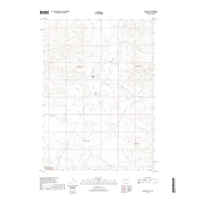
2017 Map of Slim Butte
USGS Topo · Published 2017About this map
Slim Butte serves as a focal point for this 2017 survey of the South Dakota landscape within the Pine Ridge area. The terrain is defined by the winding course of the White River, which is fed by several tributaries including Janis Cr, Alkali Cr, and Limekiln Cr. This modern topographic study illustrates the established infrastructure of the Oglala Lakota County, showing how primary routes like BIA Hwy 41 and BIA Hwy 32 connect the local population center to the surrounding countryside. Genealogists and local historians will find the Slim Buttes Cem recorded south of the main settlement, providing a specific point of interest for family research. The map also delineates township and range boundaries, such as t36n r47w and t36n r46w, which are essential for tracing land ownership and historical property records in this portion of the northern plains.
Find a feature on this map
14 named features on this map. Tap any name to fly to it.
Don’t see what you’re looking for? This feature index may not catch every label — zoom into the map to look around manually.
Map Details
Editions of this 2017 Slim Butte Map
This is the sole edition of this map. No revisions or reprints were ever made.
Other maps of this area

1955 · Hot Springs
USGS Topo · 1:250,000

1955 · Alliance
USGS Topo · 1:250,000

1957 · Alliance
USGS Topo · 1:250,000

1958 · Alliance
USGS Topo · 1:250,000

1967 · Pine Ridge SW
USGS Topo · 1:24,000

1967 · Slim Butte SW
USGS Topo · 1:24,000

1967 · Slim Butte NW
USGS Topo · 1:24,000

1967 · Oglala
USGS Topo · 1:24,000

1967 · Slim Butte NE
USGS Topo · 1:24,000

1967 · Slim Butte
USGS Topo · 1:24,000