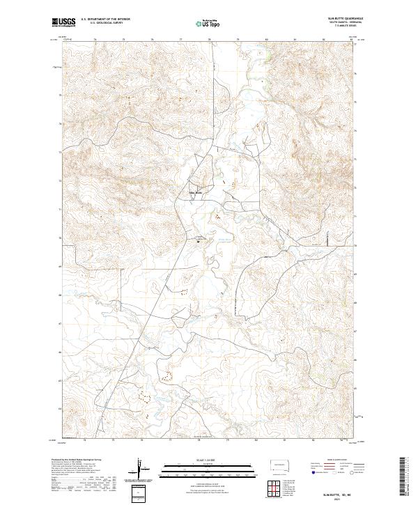
2021 Map of Slim Butte
USGS Topo · Published 2021About this map
The White River winds through this Oglala Lakota landscape, defining the hydrology of a region where several seasonal watercourses like Alkali Cr and Janis Cr converge. The terrain is dominated by the prominent landform of Slim Butte, which shares its name with the nearby settlement. This modern 2021 topographic survey illustrates the enduring rural infrastructure of the Pine Ridge area, centered around the intersection of Bia Hwy 41 and Bia Hwy 32. Local history and genealogy interest is anchored by the Slim Buttes Cem, located south of the main settlement area. The map documents the persistent boundaries of the Public Land Survey System, including t36n r47w and t35n r47w, showing how traditional township grids overlay the natural drainages of Limekiln Cr.
Find a feature on this map
15 named features on this map. Tap any name to fly to it.
Don’t see what you’re looking for? This feature index may not catch every label — zoom into the map to look around manually.
Map Details
Editions of this 2021 Slim Butte Map
This is the sole edition of this map. No revisions or reprints were ever made.
Other maps of this area

1955 · Hot Springs
USGS Topo · 1:250,000

1955 · Alliance
USGS Topo · 1:250,000

1957 · Alliance
USGS Topo · 1:250,000

1958 · Alliance
USGS Topo · 1:250,000

1967 · Pine Ridge SW
USGS Topo · 1:24,000

1967 · Slim Butte SW
USGS Topo · 1:24,000

1967 · Slim Butte NW
USGS Topo · 1:24,000

1967 · Oglala
USGS Topo · 1:24,000

1967 · Slim Butte NE
USGS Topo · 1:24,000

1967 · Slim Butte
USGS Topo · 1:24,000