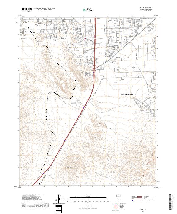
2021 Map of Sloan
USGS Topo · Published 2021About this map
Suburban expansion meets the arid landscape of the Mojave Desert in this recent survey of the southern Las Vegas Valley. Residential developments like Starr Hills Ave and the neighborhoods near Bard push south from the metro area, contrasting with the undeveloped mountain terrain to the south. The transition from grid-patterned streets to open desert is sharp, anchored by significant landmarks like the Henderson Executive Airport and the community of Henderson appearing on the eastern edge.
Find a feature on this map
114 named features on this map. Tap any name to fly to it.
Don’t see what you’re looking for? This feature index may not catch every label — zoom into the map to look around manually.
Map Details
Editions of this 2021 Sloan Map
This is the sole edition of this map. No revisions or reprints were ever made.
Other maps of this area

1907 · Las Vegas
USGS Topo · 1:250,000

1908 · Las Vegas
USGS Topo · 1:250,000

1910 · Ivanpah
USGS Topo · 1:250,000

1912 · Ivanpah
USGS Topo · 1:250,000

1942 · Ivanpah
USGS Topo · 1:250,000

1947 · Kingman
USGS Topo · 1:250,000

1948 · Kingman
USGS Topo · 1:250,000

1952 · Blue Diamond
USGS Topo · 1:62,500

1952 · Las Vegas
USGS Topo · 1:62,500

1954 · Las Vegas
USGS Topo · 1:250,000