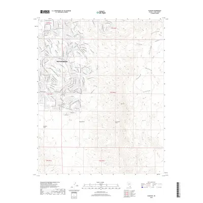
2018 Map of Sloan NE
USGS Topo · Published 2018About this map
Henderson serves as the focal point for this 2018 survey, illustrating the significant residential expansion into the northern reaches of the McCullough Range. The map documents a dense suburban network of winding streets and thoroughfares such as Anthem Pkwy and W Horizon Ridge Pkwy as they climb into the elevation of the McCullough Hills. This development patterns contrast sharply with the open, undeveloped stretches of the Mojave Desert to the south.
Find a feature on this map
111 named features on this map. Tap any name to fly to it.
Don’t see what you’re looking for? This feature index may not catch every label — zoom into the map to look around manually.
Map Details
Editions of this 2018 Sloan NE Map
This is the sole edition of this map. No revisions or reprints were ever made.
Other maps of this area

1886 · Camp Mohave
USGS Topo · 1:250,000

1886 · Saint Thomas
USGS Topo · 1:250,000

1892 · Camp Mohave
USGS Topo · 1:250,000

1893 · Saint Thomas
USGS Topo · 1:250,000

1907 · Las Vegas
USGS Topo · 1:250,000

1908 · Las Vegas
USGS Topo · 1:250,000

1910 · Ivanpah
USGS Topo · 1:250,000

1912 · Ivanpah
USGS Topo · 1:250,000

1926 · Nelson
USGS Topo · 1:96,000

1926 · Boulder Canyon
USGS Topo · 1:96,000