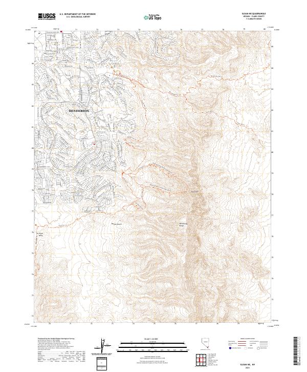
2021 Map of Sloan NE
USGS Topo · Published 2021About this map
Henderson serves as the focal point of this Nevada landscape, where suburban expansion meets the expansive reach of the Mojave Desert. The map documents a complex intersection of modern residential development and a vast network of recreational and historical paths. To the south and east, the McCullough Range rises prominently, dominated by landmarks like Black Mtn. This area is characterized by its transitioning land use, where planned neighborhoods end abruptly at the foot of the hills, giving way to a dense system of trails such as the McCullough Hills Trl and the Anthem East Trl. The inclusion of the Petroglyph Trl near the edge of the Las Vegas Valley highlights the long-standing human presence in this arid environment, providing a detailed look at how the desert's natural topography has been integrated into the modern footprint of Clark County.
Find a feature on this map
35 named features on this map. Tap any name to fly to it.
Don’t see what you’re looking for? This feature index may not catch every label — zoom into the map to look around manually.
Map Details
Editions of this 2021 Sloan NE Map
This is the sole edition of this map. No revisions or reprints were ever made.
Other maps of this area

1886 · Camp Mohave
USGS Topo · 1:250,000

1886 · Saint Thomas
USGS Topo · 1:250,000

1892 · Camp Mohave
USGS Topo · 1:250,000

1893 · Saint Thomas
USGS Topo · 1:250,000

1907 · Las Vegas
USGS Topo · 1:250,000

1908 · Las Vegas
USGS Topo · 1:250,000

1910 · Ivanpah
USGS Topo · 1:250,000

1912 · Ivanpah
USGS Topo · 1:250,000

1926 · Nelson
USGS Topo · 1:96,000

1926 · Boulder Canyon
USGS Topo · 1:96,000