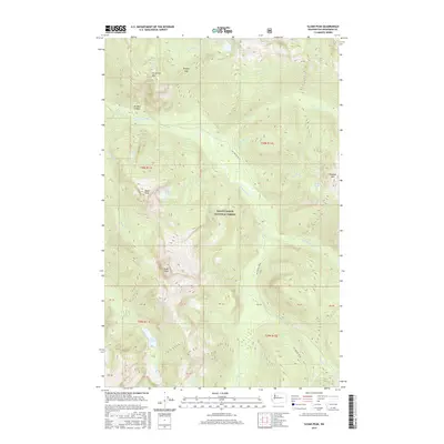
2017 Map of Sloan Peak
USGS Topo · Published 2017About this map
Mount Baker National Forest anchors this high-elevation landscape, where the N Fork Sauk River and its numerous tributaries have carved deep drainages through the Cascade Range. The terrain is dominated by prominent summits including Sloan Peak, Bedal Peak, and Ira Spring Mtn, reflecting the geological character of Snohomish County. The map reveals a high-altitude network of alpine lakes such as Goat Lake, Cadet Lake, and Sunup Lake, many of which feed into steep creeks like Elliott Cr and Sloan Cr. The primary corridor of human access is defined by Nat For Dev Rd 49, which follows the river valley. This 2017 survey provides a precise look at the hydrology and topographical naming of the area, from the narrow Penders Canyon to the notable North Fork Falls, documenting the land before any subsequent shifts in forest management or natural alteration.
Find a feature on this map
42 named features on this map. Tap any name to fly to it.
Don’t see what you’re looking for? This feature index may not catch every label — zoom into the map to look around manually.
Map Details
Editions of this 2017 Sloan Peak Map
This is the sole edition of this map. No revisions or reprints were ever made.
Other maps of this area

1899 · Glacier Peak
USGS Topo · 1:125,000

1901 · Glacier Peak
USGS Topo · 1:125,000

1902 · Skykomish
USGS Topo · 1:125,000

1905 · Skykomish
USGS Topo · 1:125,000

1950 · Glacier Peak
USGS Topo · 1:62,500

1955 · Concrete
USGS Topo · 1:250,000

1957 · Wenatchee
USGS Topo · 1:250,000

1958 · Concrete
USGS Topo · 1:250,000

1962 · Concrete
USGS Topo · 1:250,000

1965 · Monte Cristo
USGS Topo · 1:24,000