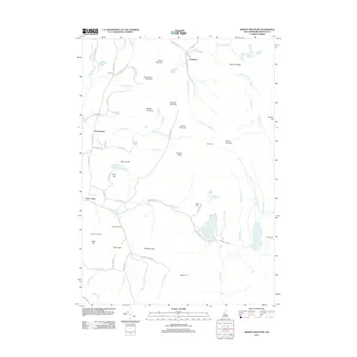
2012 Map of Smarts Mountain
USGS Topo · Published 2012About this map
Smarts Mountain dominates the high ground in this 2012 survey, anchoring a landscape of steep ridges and numerous water bodies in Grafton County. The small settlements of Lyme Center, Hardscrabble, and Quinttown are the primary hubs of human activity, connected by winding mountain roads like the Grafton Tpke. The recreation-heavy nature of the area is evident in the presence of the Dartmouth Skiway near Holts Ledge and the Trapper John Shelter on the western slopes. Multiple drainage basins are represented here, with water moving through Jacobs Brook, Grant Brook, and the Mascoma River. Notable named peaks like Stonehouse Mountain, Bundy Mountain, and Mousley Mountain define the north, while Reservoir Pond and Cummins Pond occupy the southeastern basins near DOC Camp. This map provides a look at the modern balance between small New Hampshire hamlets and the enduring wilderness of the White Mountain region.
Find a feature on this map
76 named features on this map. Tap any name to fly to it.
Don’t see what you’re looking for? This feature index may not catch every label — zoom into the map to look around manually.
Map Details
Editions of this 2012 Smarts Mountain Map
This is the sole edition of this map. No revisions or reprints were ever made.
Other maps of this area

1927 · Cardigan
USGS Topo · 1:62,500

1927 · Mascoma
USGS Topo · 1:62,500

1928 · Rumney
USGS Topo · 1:62,500

1930 · Cardigan
USGS Topo · 1:62,500

1931 · Mt. Cube
USGS Topo · 1:62,500

1932 · Mascoma
USGS Topo · 1:62,500

1932 · Rumney
USGS Topo · 1:62,500

1933 · Mt. Cube
USGS Topo · 1:62,500

1949 · Portland
USGS Topo · 1:250,000

1950 · Glens Falls
USGS Topo · 1:250,000