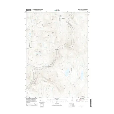
2015 Map of Smarts Mountain
USGS Topo · Published 2015About this map
Smarts Mountain and the surrounding high ground of the Appalachian National Scenic Trail dominate this landscape between the Connecticut and Mascoma river valleys. The terrain is marked by numerous family-named landmarks and peaks, including Mousley Mtn, Moody Mtn, and Smith Mtn, alongside the dramatic verticality of Winslow Ledge and Holts Ledge. Small settlements such as Quinttown, Lyme Center, and Hardscrabble are connected by a network of rural routes like Grafton Tpke and Dorchester Rd. The area is notably water-rich, featuring numerous basins like Reservoir Pond, Lily Pond, and Trout Pond that feed into the Mascoma River and drainage systems like Jacobs Brook. This survey illustrates a modern mountain landscape where local history is preserved in named hills like Demmick Hill and Flint Hill alongside long-established hiking routes.
Find a feature on this map
74 named features on this map. Tap any name to fly to it.
Don’t see what you’re looking for? This feature index may not catch every label — zoom into the map to look around manually.
Map Details
Editions of this 2015 Smarts Mountain Map
This is the sole edition of this map. No revisions or reprints were ever made.
Other maps of this area

1927 · Cardigan
USGS Topo · 1:62,500

1927 · Mascoma
USGS Topo · 1:62,500

1928 · Rumney
USGS Topo · 1:62,500

1930 · Cardigan
USGS Topo · 1:62,500

1931 · Mt. Cube
USGS Topo · 1:62,500

1932 · Mascoma
USGS Topo · 1:62,500

1932 · Rumney
USGS Topo · 1:62,500

1933 · Mt. Cube
USGS Topo · 1:62,500

1949 · Portland
USGS Topo · 1:250,000

1950 · Glens Falls
USGS Topo · 1:250,000