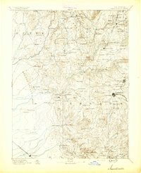
1894 Map of Smartsville
USGS Topo · Published 1894About this map
Nevada City and Grass Valley anchor the eastern edge of this late nineteenth-century survey, a landscape defined by the deep canyons of the Yuba River branches. The map documents a transition from early gold-rush mining camps to an established industrial and ranching network. Major hydraulic and quartz mining operations are evident at sites like the Empire Mine and the sprawling debris fields around Smartsville.
Find a feature on this map
154 named features on this map. Tap any name to fly to it.
Don’t see what you’re looking for? This feature index may not catch every label — zoom into the map to look around manually.
Map Details
Editions of this 1894 Smartsville Map
This is the sole edition of this map. No revisions or reprints were ever made.
Other maps of this area

1888 · Marysville
USGS Topo · 1:125,000

1888 · Smartsville
USGS Topo · 1:125,000

1888 · Bidwell Bar
USGS Topo · 1:125,000

1891 · Bidwell Bar
USGS Topo · 1:125,000

1891 · Chico
USGS Topo · 1:125,000
1891 · Downieville
USGS Topo · 1:125,000

1891 · Sacramento
USGS Topo · 1:125,000

1891 · Colfax
USGS Topo · 1:125,000

1891 · Marysville
USGS Topo · 1:125,000

1891 · Smartsville
USGS Topo · 1:125,000