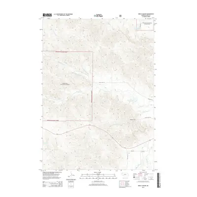
2014 Map of Smiley Canyon
USGS Topo · Published 2014About this map
Nebraska National Forest and the Oglala National Grassland meet in this corner of Sioux County, where the Pine Ridge escarpment gives way to the high plains. The landscape is defined by the complex drainage systems of Soldier Cr and its tributaries, including the N Fork Soldier Cr and Middle Fork Soldier Cr, which carve through the terrain north of Us-20. The namesake Smiley Canyon provides a natural corridor for travel, tracked by Old Smiley Scenic Dr as it winds toward the southern boundary. Water resources are central to the area's geography, with the White River appearing in the southeast alongside Carter P Johnson Reservoir and Dunlap Reservoir. These water bodies and creeks like Dead Mans Cr and Charcoal Cr illustrate the vital network supporting life and transit in this sparsely populated region of western Nebraska.
Find a feature on this map
20 named features on this map. Tap any name to fly to it.
Don’t see what you’re looking for? This feature index may not catch every label — zoom into the map to look around manually.
Map Details
Editions of this 2014 Smiley Canyon Map
This is the sole edition of this map. No revisions or reprints were ever made.
Other maps of this area

1955 · Alliance
USGS Topo · 1:250,000

1957 · Alliance
USGS Topo · 1:250,000

1958 · Alliance
USGS Topo · 1:250,000

1980 · Horn
USGS Topo · 1:24,000

1980 · Kyle Creek
USGS Topo · 1:24,000

1980 · Smiley Canyon
USGS Topo · 1:24,000

1980 · Five Points
USGS Topo · 1:24,000

1980 · Andrews
USGS Topo · 1:24,000
1980 · Roundtop
USGS Topo · 1:24,000

1980 · Dead Mans Creek
USGS Topo · 1:24,000