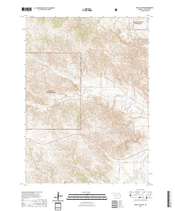
2021 Map of Smiley Canyon
USGS Topo · Published 2021About this map
The Nebraska National Forest and Oglala National Grassland meet in this high plains landscape, where complex drainage systems and recreational trails define the local geography. The map reveals an intricate network of pathways through Smiley Canyon, including the Old Smiley Scenic Dr and specialized routes like the Boots And Saddle Trl and Trooper Trl. This area serves as a significant watershed, with Soldier Creek feeding the Carter P Johnson Reservoir and various forks of the creek carving through the timbered draws of the Pine Ridge region. To the south, the White River and Charcoal Creek mark the lower elevations, while family-named features like the Dunlap Reservoir and James Ranch Middle Trl suggest a history of ranching and water management in this semi-arid environment.
Find a feature on this map
53 named features on this map. Tap any name to fly to it.
Don’t see what you’re looking for? This feature index may not catch every label — zoom into the map to look around manually.
Map Details
Editions of this 2021 Smiley Canyon Map
This is the sole edition of this map. No revisions or reprints were ever made.
Other maps of this area

1955 · Alliance
USGS Topo · 1:250,000

1957 · Alliance
USGS Topo · 1:250,000

1958 · Alliance
USGS Topo · 1:250,000

1980 · Horn
USGS Topo · 1:24,000

1980 · Kyle Creek
USGS Topo · 1:24,000

1980 · Smiley Canyon
USGS Topo · 1:24,000

1980 · Five Points
USGS Topo · 1:24,000

1980 · Andrews
USGS Topo · 1:24,000
1980 · Roundtop
USGS Topo · 1:24,000

1980 · Dead Mans Creek
USGS Topo · 1:24,000