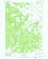
1973 Map of Smith Creek
USGS Topo · Published 1976About this map
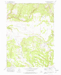
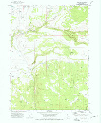
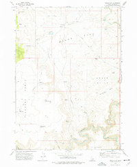
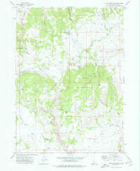
Juniper Mountain and Rough Mountain dominate this corner of Owyhee County, where high-elevation plateaus are broken by a complex network of canyons and springs. During the early 1970s, the landscape was primarily defined by livestock operations and rugged interior access, as evidenced by Star Ranch and the presence of Craig Camp in the southern reaches of Big Tree Canyon. Water is the critical resource in this arid environment, marked by dozens of named water sources such as Castlehead Springs, Buckskin Spring, and Boggy Spring. Local navigation relies on primitive routes, including the Jeep Trail and the Grasshopper Trail (Pack), which connect high-country landmarks like The Monuments and Smith Meadow. The map provides a clear picture of the remote grazing and pack-trail geography of southwestern Idaho before modern developments altered these traditional mountain uses.
Find a feature on this map
47 named features on this map. Tap any name to fly to it.
Don’t see what you’re looking for? This feature index may not catch every label — zoom into the map to look around manually.
Map Details
Editions of this 1973 Smith Creek Map
This is the sole edition of this map. No revisions or reprints were ever made.
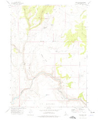
Other maps of this area

1955 · Jordan Valley
USGS Topo · 1:250,000

1957 · Jordan Valley
USGS Topo · 1:250,000

1958 · Jordan Valley
USGS Topo · 1:250,000
1973 · Red Basin
USGS Topo · 1:24,000
1973 · Bedstead Ridge
USGS Topo · 1:24,000
1973 · Castro Table
USGS Topo · 1:24,000
1973 · Pleasant Valley
USGS Topo · 1:24,000
1973 · Fairylawn
USGS Topo · 1:24,000
1973 · Brace Flat
USGS Topo · 1:24,000
1973 · Slack Mountain
USGS Topo · 1:24,000