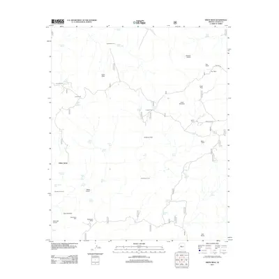
2012 Map of Smith Mesa
USGS Topo · Published 2012About this map
Smith Mesa dominates this Yavapai County landscape, defined by its high plateaus and a complex network of seasonal water sources crucial for the region's ranching heritage. The presence of several working sites, including Dumbbell Ranch, Spider Ranch, and various livestock enclosures like Smith Mesa Corral and Cowboy Corral, indicates a landscape long utilized for grazing. The terrain is marked by sharp elevation changes at Sycamore Rim and prominent landforms such as Eagle Peak and Owl Rocks.
Find a feature on this map
52 named features on this map. Tap any name to fly to it.
Don’t see what you’re looking for? This feature index may not catch every label — zoom into the map to look around manually.
Map Details
Editions of this 2012 Smith Mesa Map
This is the sole edition of this map. No revisions or reprints were ever made.
Other maps of this area

1887 · Prescott
USGS Topo · 1:250,000

1892 · Prescott
USGS Topo · 1:250,000

1947 · Simmons
USGS Topo · 1:62,500

1947 · Iron Springs
USGS Topo · 1:62,500

1947 · Sheridan Mountain
USGS Topo · 1:62,500

1947 · Camp Wood
USGS Topo · 1:62,500

1948 · Sheridan Mountain
USGS Topo · 1:63,360

1948 · Iron Springs
USGS Topo · 1:63,360

1948 · Camp Wood
USGS Topo · 1:63,360

1948 · Simmons
USGS Topo · 1:63,360