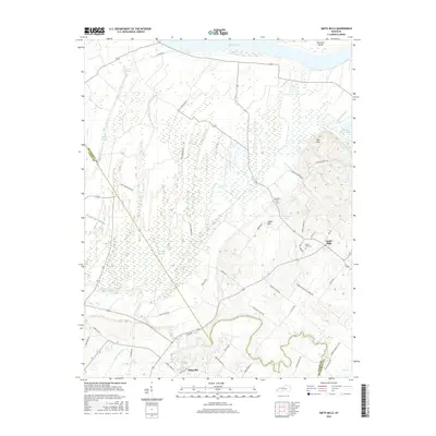
2016 Map of Smith Mills
USGS Topo · Published 2016About this map
Smith Mills and Hitesville anchor this western Kentucky landscape where the fertile bottomlands meet the meandering bends of the Ohio River. The geography is defined by a complex network of waterways, including Highland Creek and numerous wetlands such as Fishtrap Slough, Hogan Slough, and Hoagland Slough. These drainage patterns reflect the low-lying character of the Henderson and Union County border, punctuated by the rise of the Cabell Hills and Cape Hills.
Find a feature on this map
49 named features on this map. Tap any name to fly to it.
Don’t see what you’re looking for? This feature index may not catch every label — zoom into the map to look around manually.
Map Details
Editions of this 2016 Smith Mills Map
This is the sole edition of this map. No revisions or reprints were ever made.
Other maps of this area

1906 · Sebree
USGS Topo · 1:62,500

1907 · Morganfield
USGS Topo · 1:62,500

1914 · Henderson
USGS Topo · 1:48,000

1916 · Henderson
USGS Topo · 1:62,500

1917 · Uniontown
USGS Topo · 1:62,500

1949 · Morganfield
USGS Topo · 1:24,000

1949 · Poole
USGS Topo · 1:24,000

1951 · Poole
USGS Topo · 1:24,000

1951 · Waverly
USGS Topo · 1:24,000
1951 · Morganfield
USGS Topo · 1:24,000