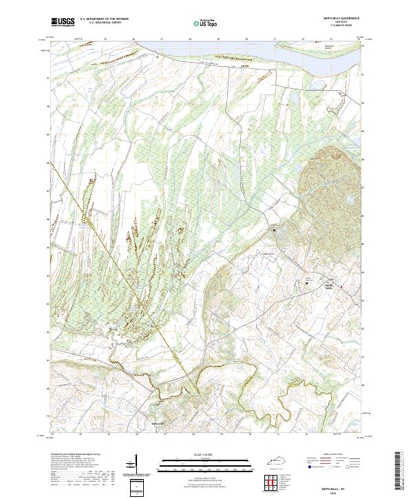
2022 Map of Smith Mills
USGS Topo · Published 2022About this map
The Ohio River forms the northern boundary of this Kentucky landscape, where the alluvial lowlands meet the rolling elevations of the Cabell Hills and Cape Hills. The map details a complex system of waterways, including Hogan Slough, Hogland Slough, and Fishtrap Slough, which drain the flat bottomlands near Diamond Island. At the intersection of State HWY 1837 and Smith Mills Rd, the settlement of Smith Mills serves as a local hub, featuring the Smith Mills Cem. To the south, the community of Hitesville sits near the headwaters of Mason Cr and Little Mason Cr. The mapping reflects a landscape defined by its transition from river-fed wetlands to upland agricultural tracts, with family-named routes like J J Utley RD and Martin-Culver RD providing a window into the rural road network of Henderson and Union Counties.
Find a feature on this map
56 named features on this map. Tap any name to fly to it.
Don’t see what you’re looking for? This feature index may not catch every label — zoom into the map to look around manually.
Map Details
Editions of this 2022 Smith Mills Map
This is the sole edition of this map. No revisions or reprints were ever made.
Other maps of this area

1906 · Sebree
USGS Topo · 1:62,500

1907 · Morganfield
USGS Topo · 1:62,500

1914 · Henderson
USGS Topo · 1:48,000

1916 · Henderson
USGS Topo · 1:62,500

1917 · Uniontown
USGS Topo · 1:62,500

1949 · Morganfield
USGS Topo · 1:24,000

1949 · Poole
USGS Topo · 1:24,000

1951 · Poole
USGS Topo · 1:24,000

1951 · Waverly
USGS Topo · 1:24,000
1951 · Morganfield
USGS Topo · 1:24,000