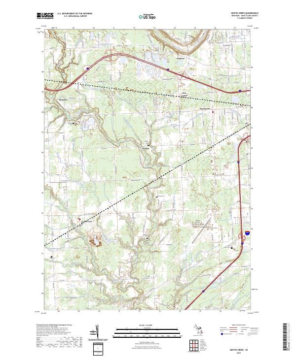
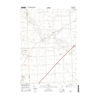
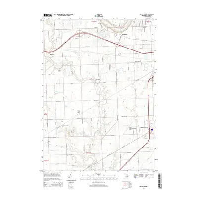
2023 Map of Smiths Creek
USGS Topo · Published 2023About this map
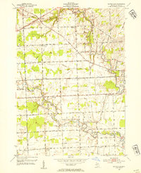
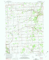
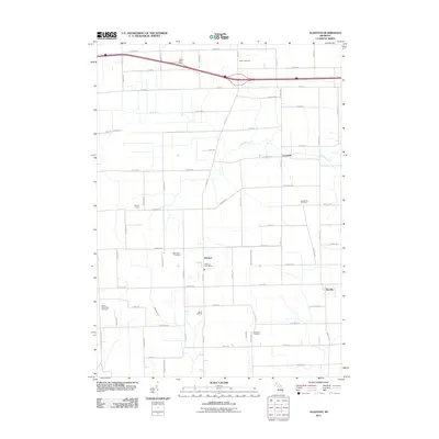
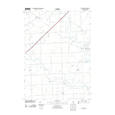
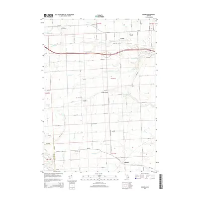
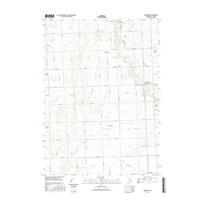
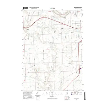
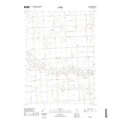
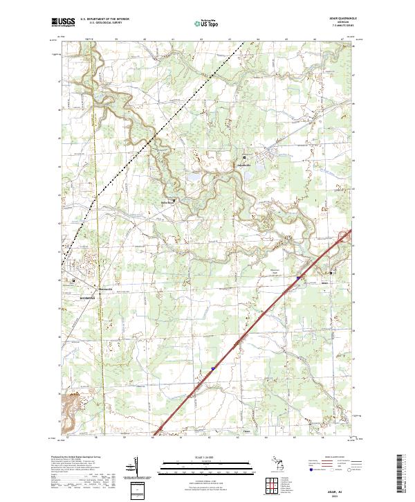
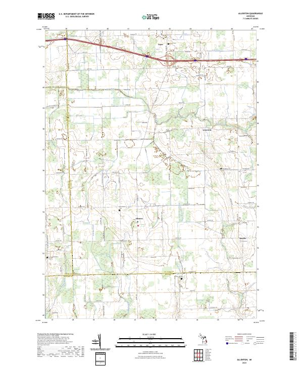
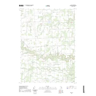
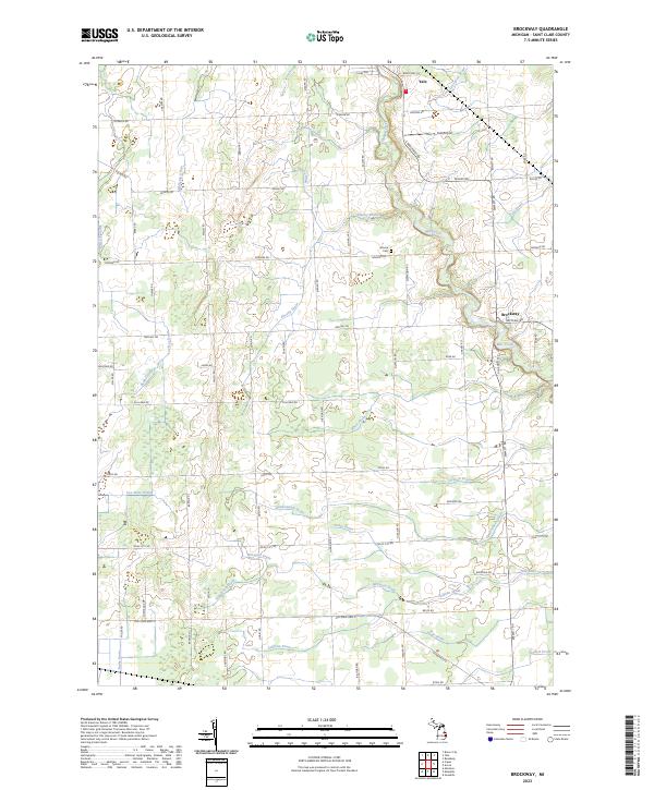
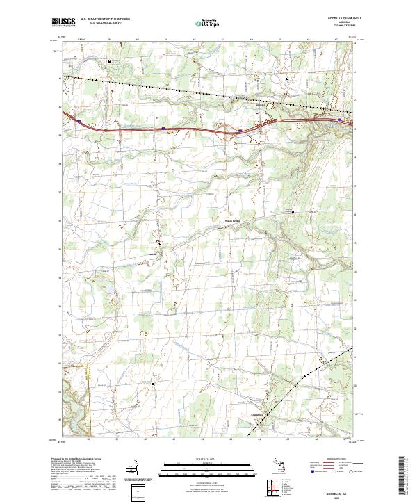
Smiths Creek and the surrounding township lands in St. Clair County are defined by an intricate network of managed watercourses like Drain Number Two Hundred Two and the Wolvin Drain. These man-made and natural channels illustrate the region's long-standing focus on agricultural drainage and land management between the Black River and the Pine River. Small settlements such as Kimball, Thornton, and Sparlingville anchor the landscape, which is also shaped by the presence of the St Clair County International Airport. For those tracing family histories, several burial grounds are scattered across the quadrangle, including Bartlett Cem, Mallory Cem, and Saint Marys Cem. The map reveals the modern intersection of transit and rural life, where long-established roads like Lapeer Rd and the Pine River valley support both residential clusters and larger infrastructure projects near the Great Lakes corridor.
Find a feature on this map
119 named features on this map. Tap any name to fly to it.
Don’t see what you’re looking for? This feature index may not catch every label — zoom into the map to look around manually.
Map Details
Editions of this 2023 Smiths Creek Map
This is the sole edition of this map. No revisions or reprints were ever made.
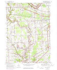
Historical Maps of Marysville Through Time
74 maps found

1928 Hicky
St. Clair County, MI

1936 Rattle Run
St. Clair County, MI

1939 Adair
St. Clair County, MI

1939 Goodells
St. Clair County, MI

1939 Smiths Creek
St. Clair County, MI

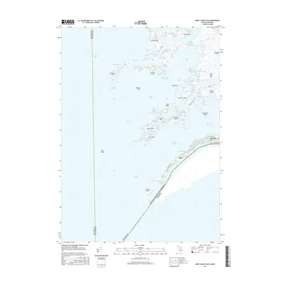
1939 St. Clair Flats
St. Clair County, MI
1942 Rattle Run
St. Clair County, MI

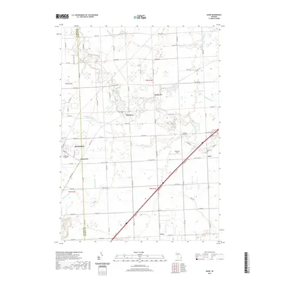
1945 Allenton
St. Clair County, MI
1949 St. Clair Flats
St. Clair County, MI

1952 Adair
St. Clair County, MI

1952 Allenton
St. Clair County, MI
1952 Goodells
St. Clair County, MI
1952 Rattle Run
St. Clair County, MI

1952 Smiths Creek
St. Clair County, MI

1952 St. Clair Flats
St. Clair County, MI
1961 Avoca
St. Clair County, MI
1961 Brockway
St. Clair County, MI
1968 Adair
St. Clair County, MI

1968 Allenton
St. Clair County, MI
1968 Goodells
St. Clair County, MI

1968 Rattle Run
St. Clair County, MI
1968 Smiths Creek
St. Clair County, MI
1968 St. Clair Flats
St. Clair County, MI

1981 Lake St. Clair North
St. Clair County, MI

1991 Adair
St. Clair County, MI

1991 Allenton
St. Clair County, MI

1991 Goodells
St. Clair County, MI

1991 Rattle Run
St. Clair County, MI

1991 Smiths Creek
St. Clair County, MI
2011 Adair
St. Clair County, MI
2011 Allenton
St. Clair County, MI
2011 Avoca
St. Clair County, MI
2011 Brockway
St. Clair County, MI
2011 Goodells
St. Clair County, MI
2011 Marine City OE E
St. Clair County, MI
2011 Rattle Run
St. Clair County, MI
2011 Saint Clair Flats
St. Clair County, MI
2011 Smiths Creek
St. Clair County, MI
2014 Adair
St. Clair County, MI
2014 Allenton
St. Clair County, MI
2014 Avoca
St. Clair County, MI
2014 Brockway
St. Clair County, MI
2014 Goodells
St. Clair County, MI
2014 Marine City OE E
St. Clair County, MI
2014 Rattle Run
St. Clair County, MI
2014 Saint Clair Flats
St. Clair County, MI
2014 Smiths Creek
St. Clair County, MI
2017 Adair
St. Clair County, MI
2017 Allenton
St. Clair County, MI
2017 Avoca
St. Clair County, MI
2017 Brockway
St. Clair County, MI
2017 Goodells
St. Clair County, MI
2017 Marine City OE E
St. Clair County, MI
2017 Rattle Run
St. Clair County, MI
2017 Saint Clair Flats
St. Clair County, MI
2017 Smiths Creek
St. Clair County, MI
2019 Adair
St. Clair County, MI
2019 Allenton
St. Clair County, MI
2019 Avoca
St. Clair County, MI
2019 Brockway
St. Clair County, MI
2019 Goodells
St. Clair County, MI
2019 Marine City OE E
St. Clair County, MI
2019 Rattle Run
St. Clair County, MI
2019 Saint Clair Flats
St. Clair County, MI
2019 Smiths Creek
St. Clair County, MI
2023 Adair
St. Clair County, MI
2023 Allenton
St. Clair County, MI
2023 Avoca
St. Clair County, MI
2023 Brockway
St. Clair County, MI
2023 Goodells
St. Clair County, MI
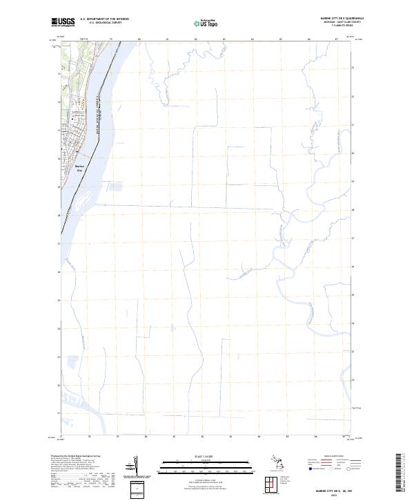
2023 Marine City OE E
St. Clair County, MI
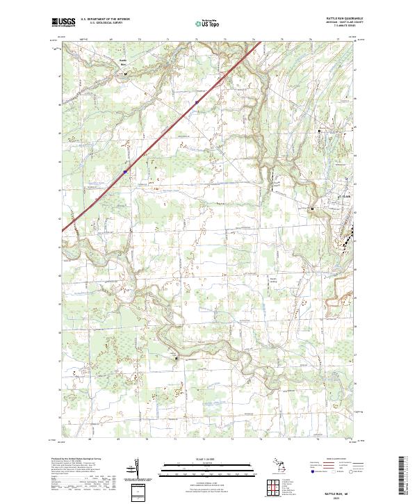
2023 Rattle Run
St. Clair County, MI
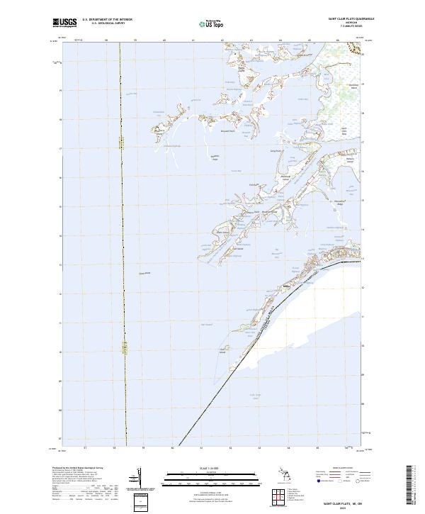
2023 Saint Clair Flats
St. Clair County, MI
2023 Smiths Creek
St. Clair County, MI
Featured Locations
- Port Huron Charter Township, MI
- Columbus Township, MI
- Marysville, MI
- Kimball, Kimball Township
- West Tappan, Kimball Township