
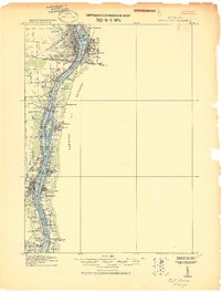
1939 Map of Smiths Creek
USGS Topo · Published 1939About this map
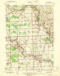
The Pere Marquette and Grand Trunk Western railroads cross the agricultural landscape of St. Clair County, converging near the settlement of Smiths Creek. This 1930s survey reveals a rural society structured around local crossroads and one-room schoolhouses like the Canada Settlement Sch, McCormick Sch, and Thornton Sch. The northern portion of the map is defined by the winding course of the Black River near Wadhams, while the burgeoning Port Huron Airport suggests the shift toward modern infrastructure. Genealogists will find significant value in the documentation of several family-named landmarks and rural burial grounds, including the Caswell Cem, Smith Cem, and St Marys Cem. The map illustrates the transition from a traditional rail-based economy toward a localized automotive network, evidenced by the named county roads connecting clusters like Sparlingville and Thornton.
Find a feature on this map
52 named features on this map. Tap any name to fly to it.
Don’t see what you’re looking for? This feature index may not catch every label — zoom into the map to look around manually.
Map Details
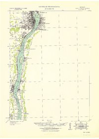
Editions of this 1939 Smiths Creek Map
This is the sole edition of this map. No revisions or reprints were ever made.
Other maps of this area
1912 · Port Huron
USGS Topo · 1:62,500

1928 · Hicky
USGS Topo · 1:62,500
1929 · Port Huron
USGS Topo · 1:62,500

1936 · St. Clair
USGS Topo · 1:31,680

1936 · Rattle Run
USGS Topo · 1:31,680

1939 · Adair
USGS Topo · 1:24,000
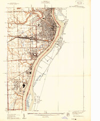
1939 · Port Huron
USGS Topo · 1:24,000
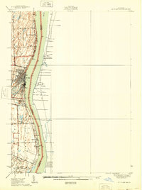
1939 · St. Clair
USGS Topo · 1:24,000

1939 · Goodells
USGS Topo · 1:24,000
1942 · Rattle Run
USGS Topo · 1:24,000
Featured Places
- Marysville, MI
- Kimball, Kimball Township
- West Tappan, Kimball Township
- Columbus Township, MI
- Smiths Creek, Kimball Township