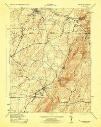
1944 Map of Smithsburg
USGS Topo · Published 1944About this map
The Mason-Dixon Line bisects this 1944 survey, where Pennsylvania and Maryland meet along the ridge of Blue Mountain. This era shows a landscape defined by water and transit, with the Western Maryland and Pennsylvania railroads threading through the valleys to serve settlements like Waynesboro and Smithsburg. Local industry and infrastructure are well-documented, from the agricultural processing at Woods Mill and Bowmans Mill to the Civilian Public Service Camp located west of Leitersburg. The mountain terrain is prominent, featuring the Appalachian Trail winding past Quirauk Mountain and High Rock. High-elevation landmarks like Pen Mar Park and Buena Vista Springs mark the resort history of the region, while essential utility sites such as the Edgemont Reservoir and Hagerstown Reservoir reflect the growing municipal needs of the mid-1940s.
Find a feature on this map
50 named features on this map. Tap any name to fly to it.
Don’t see what you’re looking for? This feature index may not catch every label — zoom into the map to look around manually.
Map Details
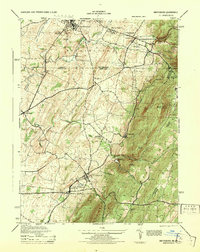
Editions of this 1944 Smithsburg Map
2 editions found
Other maps of this area

1902 · Chambersburg
USGS Topo · 1:62,500

1909 · Fairfield
USGS Topo · 1:62,500

1909 · Hagerstown
USGS Topo · 1:48,000

1911 · Emmitsburg
USGS Topo · 1:62,500

1912 · Hagerstown
USGS Topo · 1:62,500

1942 · Hagerstown
USGS Topo · 1:125,000

1942 · Gettysburg
USGS Topo · 1:125,000

1943 · Emmitsburg
USGS Topo · 1:62,500

1943 · Hagerstown
USGS Topo · 1:125,000

1943 · Chambersburg
USGS Topo · 1:62,500
Featured Places
- Waynesboro, PA
- Smithsburg, MD
- Wayne Heights, Washington Township
- Cavetown, MD
- Pen Mar, Washington Township