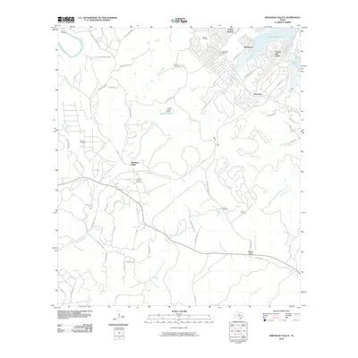
2010 Map of Smithson Valley
USGS Topo · Published 2010About this map
Canyon Lake dominates the northern landscape of this Comal County quadrangle, where the residential pockets of Westhaven and Canyon Lake Forest meet the water's edge. The terrain is defined by a series of ephemeral watercourses including West Fork Dry Comal Creek and Dry Bear Creek, cutting through prominent elevations such as Startz Hill and Split Mountain. For local historians and genealogists, the map is remarkably dense with family-named burial grounds, including the Smithson Valley Cemetery, Heimer Cemetery, and Kraft Cemetery.
Find a feature on this map
71 named features on this map. Tap any name to fly to it.
Don’t see what you’re looking for? This feature index may not catch every label — zoom into the map to look around manually.
Map Details
Editions of this 2010 Smithson Valley Map
This is the sole edition of this map. No revisions or reprints were ever made.
Other maps of this area

1920 · Smithsons Valley
USGS Topo · 1:62,500

1925 · Hunter No 3
USGS Topo · 1:48,000

1925 · Smithson Valley No. 1
USGS Topo · 1:48,000

1927 · New Braunfels
USGS Topo · 1:62,500

1927 · Smithson Valley
USGS Topo · 1:62,500

1929 · Hunter
USGS Topo · 1:62,500

1929 · Smithson Valley
USGS Topo · 1:62,500

1940 · Smithson Valley
USGS Topo · 1:62,500

1953 · Bulverde
USGS Topo · 1:24,000

1953 · Bat Cave
USGS Topo · 1:24,000