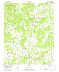
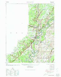
1965 Map of Smithville
USGS Topo · Published 1980About this map
The Strawberry River meanders through the heart of this mid-1960s Ozark foothills landscape, creating a complex drainage network defined by Cooper Creek, Machine Creek, and Little Creek. The area is anchored by the historic settlement of Smithville, with smaller communities like Jesup and Lynn situated near the southern and western margins. These rural centers are connected by a network of winding roads that cross the county line between Sharp and Lawrence counties. Local history is deeply etched into the land through family and community landmarks such as Townsend Cem, Bratcher Cem, and the Union Missionary Ch. The mapping reveals a transition between the uplands of South Lebanon and the lower river valleys, where land use is characterized by small-scale agriculture and resources like the Gravel Pit near the river bend.
Find a feature on this map
28 named features on this map. Tap any name to fly to it.
Don’t see what you’re looking for? This feature index may not catch every label — zoom into the map to look around manually.
Map Details
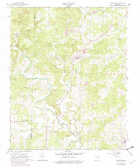
Editions of this 1965 Smithville Map
3 editions found
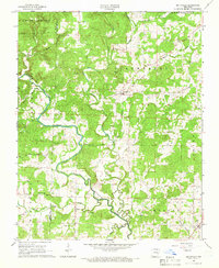
Other maps of this area

1932 · Strawberry
USGS Topo · 1:62,500
1934 · Powhatan
USGS Topo · 1:62,500
1935 · Powhatan
USGS Topo · 1:62,500

1935 · Alicia
USGS Topo · 1:62,500

1935 · Strawberry
USGS Topo · 1:62,500

1941 · Strawberry
USGS Topo · 1:62,500

1953 · Memphis
USGS Topo · 1:250,000
1955 · Strawberry
USGS Topo · 1:24,000

1956 · Memphis
USGS Topo · 1:250,000

1957 · Poplar Bluff
USGS Topo · 1:250,000