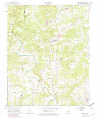
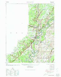
1965 Map of Smithville
USGS Topo · Published 1982About this map
The Strawberry River meanders through the heart of this Lawrence County landscape, defining the local geography alongside its many tributaries like Machine Creek and Cooper Creek. In the mid-1960s, the community of Smithville served as a central hub, while Lynn anchored the southeastern corner of the quadrangle. The map reveal a landscape deeply rooted in family and faith, with numerous small burial grounds including Townsend Cem, Bratcher Cem, Hillhouse Cem, and Massey Cem scattered across the township lines. The boundary between Sharp Co and Lawrence Co bisects the western portion of the sheet, where Union Missionary Ch stands near the confluence of Big Creek and South Mill Cr. Small-scale industry is evidenced by a Gravel Pit along the river, reflecting the rural and resource-based economy of this Ozark foothills region during the mid-20th century.
Find a feature on this map
21 named features on this map. Tap any name to fly to it.
Don’t see what you’re looking for? This feature index may not catch every label — zoom into the map to look around manually.
Map Details
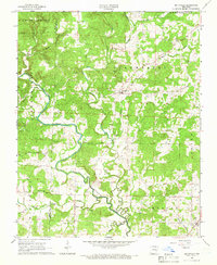
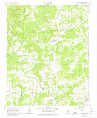
Editions of this 1965 Smithville Map
3 editions found
Other maps of this area

1932 · Strawberry
USGS Topo · 1:62,500
1934 · Powhatan
USGS Topo · 1:62,500
1935 · Powhatan
USGS Topo · 1:62,500

1935 · Alicia
USGS Topo · 1:62,500

1935 · Strawberry
USGS Topo · 1:62,500

1941 · Strawberry
USGS Topo · 1:62,500

1953 · Memphis
USGS Topo · 1:250,000
1955 · Strawberry
USGS Topo · 1:24,000

1956 · Memphis
USGS Topo · 1:250,000

1957 · Poplar Bluff
USGS Topo · 1:250,000