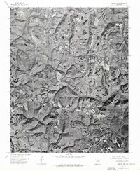
1974 Map of Smyrna NE
USGS Topo · Published 1975About this map
Tilly serves as the primary focal point of this 1974 orthophotoquad, which uses aerial imagery to document the rugged topography of Pope County. The drainage patterns of the Middle Fork Illinois Bayou and Bear Creek carve deep, complex valleys through the landscape, dictating the placement of roads and small clearings. This photographic record, prepared by the U.S. Geological Survey from imagery captured on April 9, 1974, provides a unique visual perspective that traditional line-drawn maps lack, showing the actual density of forest cover and the precise extent of agricultural fields in this part of the Ozarks. It offers a rare view of the rural settlement patterns before modern development altered the woodland boundaries.
Find a feature on this map
3 named features on this map. Tap any name to fly to it.
Don’t see what you’re looking for? This feature index may not catch every label — zoom into the map to look around manually.
Map Details
Editions of this 1974 Smyrna NE Map
This is the sole edition of this map. No revisions or reprints were ever made.
Other maps of this area

1879 · Washington
USGS Topo · 1:62,500

1887 · Smyrna
USGS Topo · 1:62,500

1889 · Marshall #3
USGS Topo · 1:62,500

1892 · Marshall
USGS Topo · 1:125,000

1894 · Marshall
USGS Topo · 1:125,000

1901 · Marshall
USGS Topo · 1:125,000

1939 · Snowball
USGS Topo · 1:62,500

1940 · Smyrna
USGS Topo · 1:62,500

1941 · Snowball
USGS Topo · 1:62,500

1942 · Snowball
USGS Topo · 1:62,500