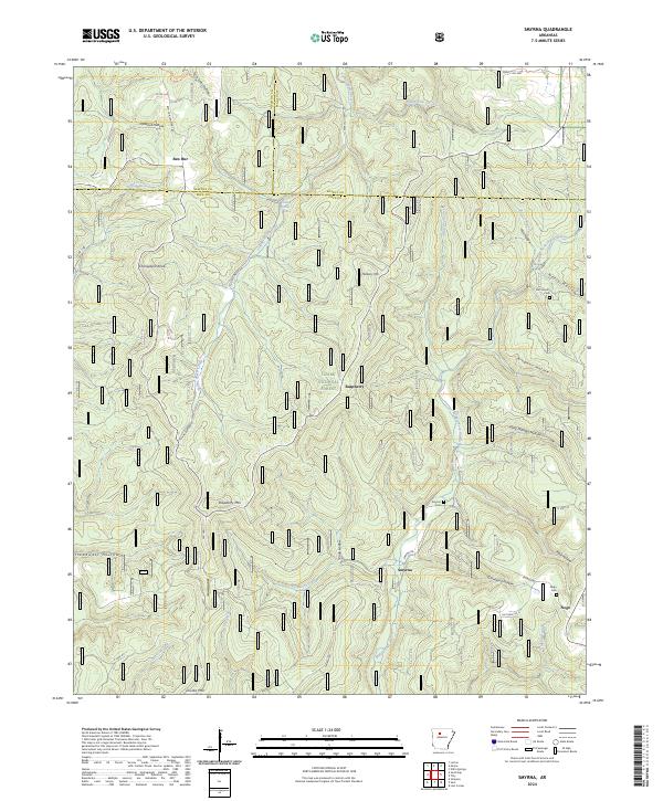
2024 Map of Smyrna
USGS Topo · Published 2024About this map
Smyrna and its neighboring rural settlements anchor this study of the steep terrain within the Ozark National Forest. The landscape is defined by deep drainages and named hollows, where the Middle Fork Illinois Bayou and Falling Water Creek carve through the highland geography. Small community centers like Ben Hur, Raspberry, and Nogo are connected by winding mountain roads such as Falling Water Rd and Smyrna Rd, which navigate the elevation between peaks like Mulberry Mtn and Chinquapin Knob. Genealogy and local history are preserved in the numerous cemeteries throughout the quadrangle, including the Old Smyrna Cem, Smyrna Cem, and Nogo Cem. Significant natural landmarks such as Falling Water Falls and various family-named drainages like Dave Millsaps Hollow and Jack Jones Hollow highlight a settlement pattern deeply tied to the specific contours of the Ozark interior.
Find a feature on this map
54 named features on this map. Tap any name to fly to it.
Don’t see what you’re looking for? This feature index may not catch every label — zoom into the map to look around manually.
Map Details
Editions of this 2024 Smyrna Map
This is the sole edition of this map. No revisions or reprints were ever made.
Other maps of this area

1879 · Washington
USGS Topo · 1:62,500

1887 · Smyrna
USGS Topo · 1:62,500

1889 · Treat
USGS Topo · 1:62,500

1889 · Marshall #3
USGS Topo · 1:62,500

1892 · Marshall
USGS Topo · 1:125,000

1894 · Marshall
USGS Topo · 1:125,000

1901 · Marshall
USGS Topo · 1:125,000

1932 · Treat
USGS Topo · 1:62,500

1933 · Mt Judea
USGS Topo · 1:62,500

1934 · Treat
USGS Topo · 1:62,500