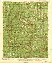
1943 Map of Smyrna
USGS Topo · Published 1943About this map
Illinois Bayou and the headwaters of the Middle Fork Little Red River carve through the high elevations of the Boston Mountains in this early 1940s survey. The landscape is defined by its isolation, dotted with small rural centers such as Smyrna, Nogo, and Ben Hur. These communities are anchored by essential civic structures, including the Union Hill Sch, Atkins Sch, and New Hope Sch. The mapping of the Old Smyrna Cem and numerous family-named peaks like Mulberry Mtn and Shields Knob provides a detailed look at the area's settlement patterns before modern development altered the rural infrastructure.
Find a feature on this map
61 named features on this map. Tap any name to fly to it.
Don’t see what you’re looking for? This feature index may not catch every label — zoom into the map to look around manually.
Map Details
Editions of this 1943 Smyrna Map
This is the sole edition of this map. No revisions or reprints were ever made.
Other maps of this area

1879 · Washington
USGS Topo · 1:62,500

1887 · Smyrna
USGS Topo · 1:62,500

1888 · Dardanelle #1
USGS Topo · 1:62,500

1889 · Treat
USGS Topo · 1:62,500

1889 · Marshall #3
USGS Topo · 1:62,500

1890 · Dardanelle
USGS Topo · 1:125,000

1892 · Marshall
USGS Topo · 1:125,000

1892 · Morrillton
USGS Topo · 1:125,000

1894 · Morrillton
USGS Topo · 1:125,000

1894 · Marshall
USGS Topo · 1:125,000