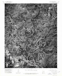
1974 Map of Smyrna SW
USGS Topo · Published 1975About this map
East Fork Illinois Bayou snakes through this high-altitude orthophotoquad in Pope County, carving a deep drainage pattern through the dense forest cover of the Arkansas interior. The 1974 aerial photography reveals a landscape defined by sharp topographical relief and isolated clearings, with the small settlement of Solo serving as a primary point of reference in this sparsely populated area. The map illustrates how human activity follows the natural contours of the land, with narrow roads and occasional homesteads clinging to the ridges above the bayou's winding course. This perspective provides a clear view of the timber and agricultural patterns before further modern development, capturing the physical character of the Ozark foothills during the mid-1970s.
Find a feature on this map
2 named features on this map. Tap any name to fly to it.
Don’t see what you’re looking for? This feature index may not catch every label — zoom into the map to look around manually.
Map Details
Editions of this 1974 Smyrna SW Map
This is the sole edition of this map. No revisions or reprints were ever made.
Other maps of this area

1879 · Washington
USGS Topo · 1:62,500

1887 · Smyrna
USGS Topo · 1:62,500

1888 · Dardanelle #1
USGS Topo · 1:62,500

1889 · Treat
USGS Topo · 1:62,500

1889 · Marshall #3
USGS Topo · 1:62,500

1890 · Dardanelle
USGS Topo · 1:125,000

1892 · Marshall
USGS Topo · 1:125,000

1892 · Morrillton
USGS Topo · 1:125,000

1894 · Morrillton
USGS Topo · 1:125,000

1894 · Marshall
USGS Topo · 1:125,000