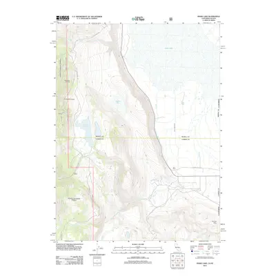
2012 Map of Snake Lake
USGS Topo · Published 2012About this map
Bare Ranch and the surrounding high-desert wetlands of Surprise Valley define this 2012 survey along the Nevada-California border. The landscape is shaped by complex water management and natural drainages, including the Bare Creek Ditch and numerous seasonal flows such as Silver Cr and North Cr. These water sources reflect the agricultural history of the region, where ranching operations rely on managed reservoirs like Sworinger Reservoir and natural features such as Van Riper Spring.
Find a feature on this map
17 named features on this map. Tap any name to fly to it.
Don’t see what you’re looking for? This feature index may not catch every label — zoom into the map to look around manually.
Map Details
Editions of this 2012 Snake Lake Map
This is the sole edition of this map. No revisions or reprints were ever made.
Other maps of this area

1886 · Alturas
USGS Topo · 1:250,000

1889 · Long Valley
USGS Topo · 1:250,000

1892 · Alturas
USGS Topo · 1:250,000

1954 · Vya
USGS Topo · 1:250,000

1954 · Alturas
USGS Topo · 1:250,000

1958 · Alturas
USGS Topo · 1:250,000

1958 · Vya
USGS Topo · 1:250,000

1962 · Alturas
USGS Topo · 1:250,000

1962 · Vya
USGS Topo · 1:250,000

1962 · Snake Lake
USGS Topo · 1:24,000