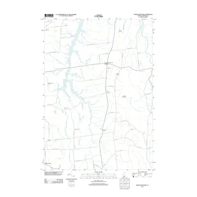
2012 Map of Snake Mountain
USGS Topo · Published 2012About this map
Snake Mountain rises prominently over the Vermont landscape, anchoring a rural environment defined by its complex drainage network and dispersed agrarian settlements. The town of Addison serves as a central hub, where the Grandview Grange and Grandview Cem sit at the intersection of local routes. The area is notable for its high density of family and community burying grounds, including Spaulding Cem, Hanks Yard Cem, and Hindes Cem, which offer significant value for genealogical research. The geography is dominated by the multi-branched Dead Cr, with its West, East, and Middle branches weaving through the valley alongside Wards Cr and the Lemon Fair River. This intricate water system, coupled with the presence of local airstrips like Spencer Airport, reflects a landscape that has maintained its agricultural and low-density character well into the 21st century.
Find a feature on this map
62 named features on this map. Tap any name to fly to it.
Don’t see what you’re looking for? This feature index may not catch every label — zoom into the map to look around manually.
Map Details
Editions of this 2012 Snake Mountain Map
This is the sole edition of this map. No revisions or reprints were ever made.
Other maps of this area

1894 · Port Henry
USGS Topo · 1:62,500

1894 · Ticonderoga
USGS Topo · 1:62,500

1896 · Ticonderoga
USGS Topo · 1:62,500

1898 · Port Henry
USGS Topo · 1:62,500

1902 · Ticonderoga
USGS Topo · 1:62,500

1902 · Brandon
USGS Topo · 1:62,500

1903 · Middlebury
USGS Topo · 1:62,500

1904 · Brandon
USGS Topo · 1:62,500

1905 · Middlebury
USGS Topo · 1:62,500

1920 · Brandon
USGS Topo · 1:62,500