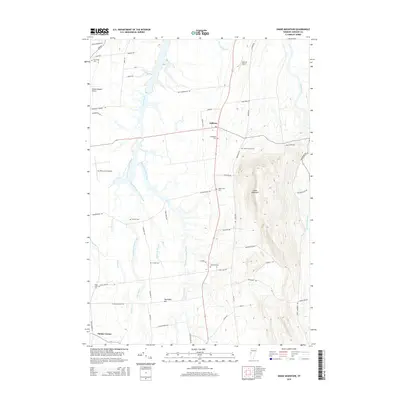
2015 Map of Snake Mountain
USGS Topo · Published 2015About this map
Snake Mountain dominates the eastern skyline of this landscape, rising sharply above the fertile Champlain Valley floor. The settlement of Addison serves as a central hub, surrounded by a complex network of waterways including the extensive Dead Creek system and its numerous branches, such as Middle Branch Dead Creek and East Branch Dead Creek. This area's agricultural and rural heritage is evident in the high density of family and community burial grounds, with Grandview Cem, Hanks Yard Cem, and Advent-Smith Cem scattered across the township. The presence of several small air strips, including Yankee Kingdom Airport and Spencer Airport, suggests a legacy of local aviation. To the south, Palmer Corner and Toothaker Hill mark the transition toward the drainage of the Lemon Fair River, while the prominent ridge of Snake Mountain provides a distinct topographic boundary for the Otter Creek basin to the east.
Find a feature on this map
64 named features on this map. Tap any name to fly to it.
Don’t see what you’re looking for? This feature index may not catch every label — zoom into the map to look around manually.
Map Details
Editions of this 2015 Snake Mountain Map
This is the sole edition of this map. No revisions or reprints were ever made.
Other maps of this area

1894 · Port Henry
USGS Topo · 1:62,500

1894 · Ticonderoga
USGS Topo · 1:62,500

1896 · Ticonderoga
USGS Topo · 1:62,500

1898 · Port Henry
USGS Topo · 1:62,500

1902 · Ticonderoga
USGS Topo · 1:62,500

1902 · Brandon
USGS Topo · 1:62,500

1903 · Middlebury
USGS Topo · 1:62,500

1904 · Brandon
USGS Topo · 1:62,500

1905 · Middlebury
USGS Topo · 1:62,500

1920 · Brandon
USGS Topo · 1:62,500