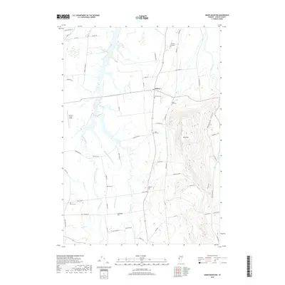
2018 Map of Snake Mountain
USGS Topo · Published 2018About this map
Addison serves as the central hub of this Champlain Valley landscape, where the flat, fertile basin of the West and Middle branches of West Branch Dead Creek meets the dramatic uplift of Snake Mtn. The map reveals a high density of small family and community burial grounds, including Grandview Cem, Hanks Yard Cem, and the Advent - Smith Cem, which provide significant genealogical anchor points for the region. The drainage patterns of Otter Creek and the Lemon Fair River define the agricultural boundaries, while the presence of specialized landing strips like Spencer Airport and Ass-Pirin Acres Airport highlights the mix of traditional farming and private aviation. On the slopes of the mountain, a Cranberry Bog sits tucked between contour lines, illustrating the varied wetland ecosystems that persist alongside established homesteads and rural routes like Jersey St.
Find a feature on this map
61 named features on this map. Tap any name to fly to it.
Don’t see what you’re looking for? This feature index may not catch every label — zoom into the map to look around manually.
Map Details
Editions of this 2018 Snake Mountain Map
This is the sole edition of this map. No revisions or reprints were ever made.
Other maps of this area

1894 · Port Henry
USGS Topo · 1:62,500

1894 · Ticonderoga
USGS Topo · 1:62,500

1896 · Ticonderoga
USGS Topo · 1:62,500

1898 · Port Henry
USGS Topo · 1:62,500

1902 · Ticonderoga
USGS Topo · 1:62,500

1902 · Brandon
USGS Topo · 1:62,500

1903 · Middlebury
USGS Topo · 1:62,500

1904 · Brandon
USGS Topo · 1:62,500

1905 · Middlebury
USGS Topo · 1:62,500

1920 · Brandon
USGS Topo · 1:62,500