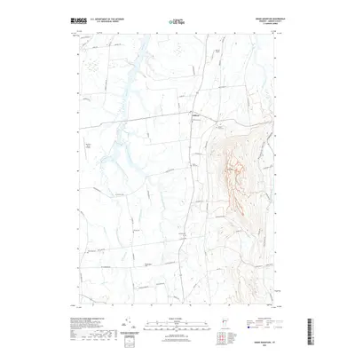
2021 Map of Snake Mountain
USGS Topo · Published 2021About this map
Snake Mountain dominates the eastern skyline of this Addison County landscape, rising sharply above the fertile lowlands of the Champlain Valley. The terrain is defined by a complex network of waterways, including the winding Dead Creek and its numerous branches, which meander toward the north alongside Otter Creek and the Lemon Fair River. This modern survey reveals a countryside still deeply rooted in its agricultural and family history, evidenced by the high density of small family and community burial grounds scattered across the township, such as Hanks Yard Cemetery and the Advent - Smith Cemetery.
Find a feature on this map
62 named features on this map. Tap any name to fly to it.
Don’t see what you’re looking for? This feature index may not catch every label — zoom into the map to look around manually.
Map Details
Editions of this 2021 Snake Mountain Map
This is the sole edition of this map. No revisions or reprints were ever made.
Other maps of this area

1894 · Port Henry
USGS Topo · 1:62,500

1894 · Ticonderoga
USGS Topo · 1:62,500

1896 · Ticonderoga
USGS Topo · 1:62,500

1898 · Port Henry
USGS Topo · 1:62,500

1902 · Ticonderoga
USGS Topo · 1:62,500

1902 · Brandon
USGS Topo · 1:62,500

1903 · Middlebury
USGS Topo · 1:62,500

1904 · Brandon
USGS Topo · 1:62,500

1905 · Middlebury
USGS Topo · 1:62,500

1920 · Brandon
USGS Topo · 1:62,500