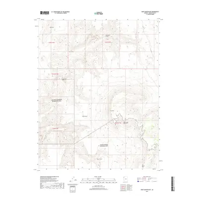
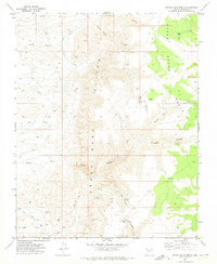
2018 Map of Snap Canyon East
USGS Topo · Published 2018About this map
Grand Canyon National Park and the Lake Mead National Recreation Area meet in this 2018 survey of the Arizona strip. The dramatic verticality of the landscape is defined by the Grand Wash Cliffs and the Upper Grand Wash Cliffs, which separate the lower desert reaches from the high Sanup Plateau. This region is defined by its extreme topography rather than human settlement, with the land deeply incised by drainages such as Snap Canyon, Cunningham Canyon, and Pearce Canyon. High vantage points like Snap Point and Fort Garrett Point provide overlooks of the complex geology. Aside from the primitive Rd 1012 and the locality of Nevershine, the map depicts a wilderness largely untouched by modern infrastructure, preserved within these overlapping federal jurisdictions.
Find a feature on this map
17 named features on this map. Tap any name to fly to it.
Don’t see what you’re looking for? This feature index may not catch every label — zoom into the map to look around manually.
Map Details
Editions of this 2018 Snap Canyon East Map
This is the sole edition of this map. No revisions or reprints were ever made.
Other maps of this area

1886 · Mt. Trumbull
USGS Topo · 1:250,000

1892 · Mt. Trumbull
USGS Topo · 1:250,000

1953 · Grand Canyon
USGS Topo · 1:250,000

1957 · Grand Canyon
USGS Topo · 1:250,000

1958 · Grand Canyon
USGS Topo · 1:250,000

1960 · Grand Canyon
USGS Topo · 1:250,000
1971 · Gyp Hills
USGS Topo · 1:24,000
1971 · Bat Cave
USGS Topo · 1:24,000
1971 · Mustang Point
USGS Topo · 1:24,000
1971 · Grand Gulch Bench
USGS Topo · 1:24,000