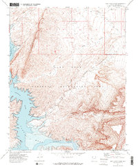
1971 Map of Snap Canyon West
USGS Topo · Published 1974About this map
The Lake Mead National Recreation Area dominates this early 1970s landscape, where the rising waters of the reservoir meet the ancient geological formations of Mohave County. Along the western edge, the sheer wall of the Cockscomb rises abruptly from Grand Wash Bay, marking a sharp division in the desert terrain. To the south, the Colorado River flows through the Lower Granite Gorge, a transition point where the river leaves the confines of the inner canyon and enters the expanse of Lake Mead. Remote water sources like Chill-Heal Spring and rugged drainages such as Pearce Canyon and Balanced Rock Canyon cut through the Grand Wash Cliffs, leading toward the high elevations of the Sanup Plateau. This survey captures the region's topography before modern recreational development fully transformed the access points along the reservoir's shoreline.
Find a feature on this map
16 named features on this map. Tap any name to fly to it.
Don’t see what you’re looking for? This feature index may not catch every label — zoom into the map to look around manually.
Map Details
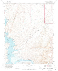
Editions of this 1971 Snap Canyon West Map
2 editions found
Other maps of this area

1886 · Saint Thomas
USGS Topo · 1:250,000

1886 · Mt. Trumbull
USGS Topo · 1:250,000

1892 · Mt. Trumbull
USGS Topo · 1:250,000

1893 · Saint Thomas
USGS Topo · 1:250,000

1926 · Bonelli
USGS Topo · 1:96,000

1953 · Iceberg Canyon
USGS Topo · 1:62,500

1953 · Gold Butte
USGS Topo · 1:62,500

1953 · Grand Canyon
USGS Topo · 1:250,000

1954 · Las Vegas
USGS Topo · 1:250,000

1957 · Las Vegas
USGS Topo · 1:250,000