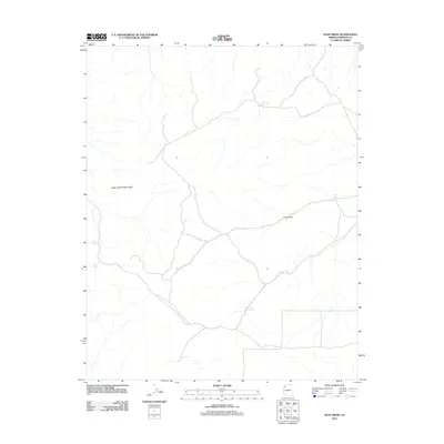
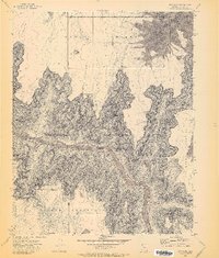
2011 Map of Snap Draw
USGS Topo · Published 2011About this map
Upper Grand Wash Cliffs dominate the western portion of this 2011 survey, marking a dramatic geological transition in this arid section of Mohave County. The landscape is defined by the ephemeral drainage of Snap Draw, which cuts through the high desert plateau. Water management is the primary evidence of human activity and ranching history in this parched environment, documented through a series of named catchment features. These include Tincanebitts Tank to the south and a cluster of livestock-related sites such as Upper Salt House Tank and Lower Salt House Tank. The reliance on local hydrology is further highlighted by the presence of Snap Spring and Gardner Tank, indicating how the remote terrain was navigated and utilized for grazing and survival long before modern mapping.
Find a feature on this map
9 named features on this map. Tap any name to fly to it.
Don’t see what you’re looking for? This feature index may not catch every label — zoom into the map to look around manually.
Map Details
Editions of this 2011 Snap Draw Map
This is the sole edition of this map. No revisions or reprints were ever made.
Other maps of this area

1886 · Mt. Trumbull
USGS Topo · 1:250,000

1892 · Mt. Trumbull
USGS Topo · 1:250,000

1953 · Grand Canyon
USGS Topo · 1:250,000

1957 · Grand Canyon
USGS Topo · 1:250,000

1958 · Grand Canyon
USGS Topo · 1:250,000

1960 · Grand Canyon
USGS Topo · 1:250,000
1971 · Castle Peak
USGS Topo · 1:24,000
1971 · Mt. Dellenbaugh
USGS Topo · 1:24,000
1971 · Wildcat Ranch
USGS Topo · 1:24,000
1971 · Bat Cave
USGS Topo · 1:24,000