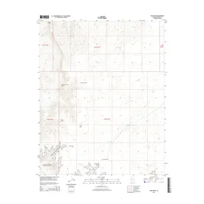
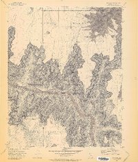
2014 Map of Snap Draw
USGS Topo · Published 2014About this map
The Upper Grand Wash Cliffs dominate this portion of Mohave County, where the high desert plateau begins its dramatic descent toward the Colorado River watershed. This landscape is defined by its drainage systems and water security, with ephemeral features like Snap Draw and Salt House Draw carving through the arid terrain. The southern reaches of the map include a portion of Grand Canyon National Park, specifically around Tincanebitts Canyon and Dry Canyon. For those studying land use in this remote corner of Arizona, the map reveals a network of vital water catchments such as Gardner Tank, Snap Tank, and the Upper Salt House Tank. These features, along with Snap Spring, trace the traditional routes and resource points used by ranchers and travelers moving across the high country near Mustang Point.
Find a feature on this map
22 named features on this map. Tap any name to fly to it.
Don’t see what you’re looking for? This feature index may not catch every label — zoom into the map to look around manually.
Map Details
Editions of this 2014 Snap Draw Map
This is the sole edition of this map. No revisions or reprints were ever made.
Other maps of this area

1886 · Mt. Trumbull
USGS Topo · 1:250,000

1892 · Mt. Trumbull
USGS Topo · 1:250,000

1953 · Grand Canyon
USGS Topo · 1:250,000

1957 · Grand Canyon
USGS Topo · 1:250,000

1958 · Grand Canyon
USGS Topo · 1:250,000

1960 · Grand Canyon
USGS Topo · 1:250,000
1971 · Castle Peak
USGS Topo · 1:24,000
1971 · Mt. Dellenbaugh
USGS Topo · 1:24,000
1971 · Wildcat Ranch
USGS Topo · 1:24,000
1971 · Bat Cave
USGS Topo · 1:24,000