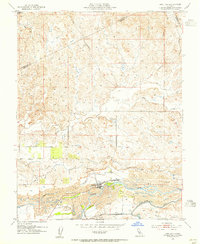
1953 Map of Snelling
USGS Topo · Published 1955About this map
Snelling serves as the focal point of this Central Valley landscape, situated just north of the Merced River. The map reveals a post-war environment where historical gold mining has fundamentally altered the terrain; extensive Dredge Tailings flank the river and Ingalsbe Slough, creating a distinct corrugated pattern across the valley floor. Agriculture and water management are evident through the complex network of the North Side Canal, Main Canal, and Crocker-Hoffman Canal, which divert water to the surrounding fields. Local transit and small-scale settlement are marked by family-named landmarks such as Halterman and Figmond along their eponymous roads. To the north, the terrain transitions into the lower foothills, drained by Dry Creek and its south fork, while the county boundaries with Stanislaus and Mariposa cut through the northern and eastern uplands.
Find a feature on this map
23 named features on this map. Tap any name to fly to it.
Don’t see what you’re looking for? This feature index may not catch every label — zoom into the map to look around manually.
Map Details
Editions of this 1953 Snelling Map
This is the sole edition of this map. No revisions or reprints were ever made.
Other maps of this area

1893 · Sonora
USGS Topo · 1:125,000

1896 · Sonora
USGS Topo · 1:125,000

1897 · Sonora
USGS Topo · 1:125,000

1898 · Sonora
USGS Topo · 1:125,000

1913 · Dickenson
USGS Topo · 1:31,680

1915 · La Grange
USGS Topo · 1:24,000

1916 · Three Tree Flat
USGS Topo · 1:31,680

1916 · Hopeton
USGS Topo · 1:31,680

1916 · Cooperstown
USGS Topo · 1:31,680

1916 · Merced Falls
USGS Topo · 1:24,000