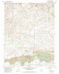
1962 Map of Snelling
USGS Topo · Published 1984About this map
The Merced River valley dominates this landscape, showing the dramatic physical evidence of industrial-scale mining operations along its banks. Extensive Ingalsbe Dredge Tailings line the river corridor near Snelling, illustrating how the search for gold reshaped the local topography. Above the flood plain, the town serves as a focal point for the surrounding ranching and agricultural land, with the Snelling-Merced Falls Sch and Henderson Park serving the local community.
Find a feature on this map
36 named features on this map. Tap any name to fly to it.
Don’t see what you’re looking for? This feature index may not catch every label — zoom into the map to look around manually.
Map Details
Editions of this 1962 Snelling Map
3 editions found
Other maps of this area

1893 · Sonora
USGS Topo · 1:125,000

1896 · Sonora
USGS Topo · 1:125,000

1897 · Sonora
USGS Topo · 1:125,000

1898 · Sonora
USGS Topo · 1:125,000

1913 · Dickenson
USGS Topo · 1:31,680

1915 · La Grange
USGS Topo · 1:24,000

1916 · Three Tree Flat
USGS Topo · 1:31,680

1916 · Hopeton
USGS Topo · 1:31,680

1916 · Cooperstown
USGS Topo · 1:31,680

1916 · Merced Falls
USGS Topo · 1:24,000