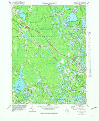
1977 Map of Snipatuit Pond
USGS Topo · Published 1979About this map
The agricultural and wetlands heritage of Southeastern Massachusetts is prominently displayed in this late 1970s survey, dominated by a vast network of Cranberry Bogs and the sweeping Forbes Swamp. The landscape is defined by the critical water resources of Snipatuit Pond and the Weweantic River, which supported the region's cranberry industry. Smaller settlements like South Middleboro and West Wareham act as local hubs, while smaller family-named corners such as Bisbee Corner and Huckleberry Corner mark old crossroads. Transportation infrastructure is represented by the Conrail line and a specialized Seaplane Base on the western shore of Snipatuit Pond. Historical and community markers are scattered throughout, including the Old Colony Technical High Sch, several early burial grounds like Hillside Cem, and the Union Ch near Sampson Pond. The area's commitment to land preservation is evident in the Rocky Gutter Wildlife Management Area and the Town Forest.
Find a feature on this map
102 named features on this map. Tap any name to fly to it.
Don’t see what you’re looking for? This feature index may not catch every label — zoom into the map to look around manually.
Map Details
Editions of this 1977 Snipatuit Pond Map
2 editions found
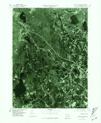
Other maps of this area

1885 · New Bedford
USGS Topo · 1:62,500

1885 · Middleboro
USGS Topo · 1:62,500

1886 · Falmouth
USGS Topo · 1:62,500

1886 · Plymouth
USGS Topo · 1:62,500

1888 · New Bedford
USGS Topo · 1:62,500

1888 · Falmouth
USGS Topo · 1:62,500

1888 · Middleboro
USGS Topo · 1:62,500

1889 · Plymouth
USGS Topo · 1:62,500

1893 · Middleboro
USGS Topo · 1:62,500

1893 · Falmouth
USGS Topo · 1:62,500