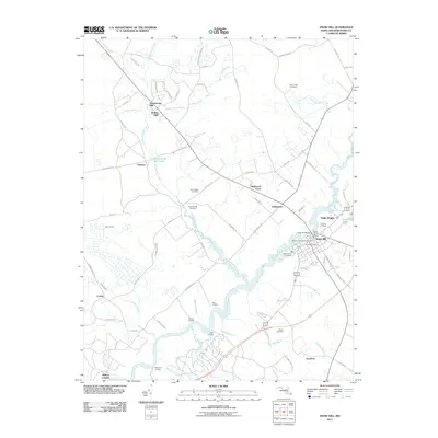
2011 Map of Snow Hill
USGS Topo · Published 2011About this map
The Pocomoke River defines the landscape of this Maryland Eastern Shore survey, winding through a series of landings and lowlands that speak to the area's maritime and industrial history. The town of Snow Hill serves as a central hub, featuring several historic burial grounds such as the Makemie Memorial Cemetery and All Hallows Cemetery, alongside the Snow Hill Post Office. To the west, the legacy of early iron production is preserved in names like Furnace and the Nassawango Mill Pond, while residential growth is visible in developments like Nassawango Hills and Rolling Hills. The geography is characterized by numerous tributaries, including Hardship Branch and Corbin Branch, which feed into the primary river system. This survey documents the intersection of modern rural life with the deep-rooted landmarks of Worcester County, from the protected reaches of the Pocomoke State Frst to family-named sites like the Taylor Gate Cemetery.
Find a feature on this map
79 named features on this map. Tap any name to fly to it.
Don’t see what you’re looking for? This feature index may not catch every label — zoom into the map to look around manually.
Map Details
Editions of this 2011 Snow Hill Map
This is the sole edition of this map. No revisions or reprints were ever made.
Other maps of this area

1901 · Snow Hill
USGS Topo · 1:62,500

1901 · Salisbury
USGS Topo · 1:62,500

1902 · Pittsville
USGS Topo · 1:62,500

1942 · Ninepin
USGS Topo · 1:24,000

1942 · Snow Hill
USGS Topo · 1:24,000

1942 · Wango
USGS Topo · 1:24,000

1942 · Wesley
USGS Topo · 1:24,000

1942 · Dividing Creek
USGS Topo · 1:24,000

1942 · Salisbury
USGS Topo · 1:24,000

1943 · Snow Hill
USGS Topo · 1:31,680