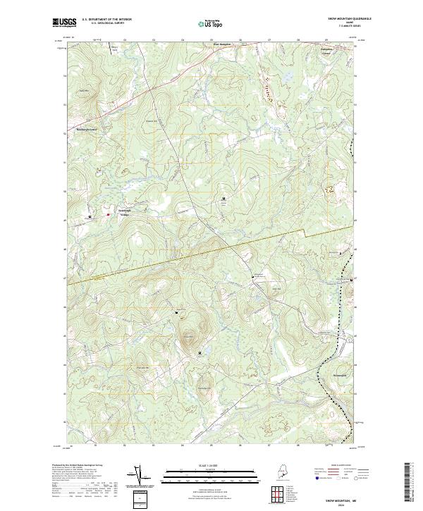
2024 Map of Snow Mountain
USGS Topo · Published 2024About this map
Newburgh Center and Newburgh Village anchor the western reaches of this landscape, situated at the boundary between Penobscot and Waldo counties. The area is defined by a series of prominent rises, including Kelly Mtn, Pickard Hill, and the central summit of Snow Mtn. A network of small streams and brooks, such as West Branch Souadabscook Stream and Marsh Stream, drain the undulating terrain, punctuated by features like Alger Pond and the Burnt Swamp. Genealogists and local historians will find value in the numerous small burial grounds dispersed throughout the countryside, such as Neallys Corner Cem, Ellingwood Corner Cem, and Coles Corner Cem, which reflect the early settlement patterns of these rural townships. The map details the transition from the settled centers of West Hampden and Hampden Center toward the southern town of Winterport.
Find a feature on this map
79 named features on this map. Tap any name to fly to it.
Don’t see what you’re looking for? This feature index may not catch every label — zoom into the map to look around manually.
Map Details
Editions of this 2024 Snow Mountain Map
This is the sole edition of this map. No revisions or reprints were ever made.
Other maps of this area

1900 · Bucksport
USGS Topo · 1:62,500

1902 · Bucksport
USGS Topo · 1:62,500

1902 · Bangor
USGS Topo · 1:62,500

1931 · Stetson
USGS Topo · 1:48,000

1932 · Brooks
USGS Topo · 1:62,500

1935 · Stetson
USGS Topo · 1:62,500

1942 · Bangor
USGS Topo · 1:62,500

1942 · Bucksport
USGS Topo · 1:62,500

1946 · Bangor
USGS Topo · 1:62,500

1948 · Bangor
USGS Topo · 1:250,000