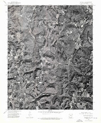
1974 Map of Snowball SE
USGS Topo · Published 1975About this map
Witt Springs anchors the southwest corner of this 1974 orthophotoquad, where the local road network converges among the plateau-like ridges of Searcy County. Unlike a traditional topographic map, this aerial perspective provides a literal look at the land cover and forest clearing patterns of the mid-1970s. The drainage systems of Calf Creek and Bear Creek carve deep, visible valleys into the terrain, revealing the sharp contrast between the wooded slopes and the agricultural patches found in the bottomlands. This imagery serves as a precise record of rural Arkansas just before the mid-1970s, showing the exact footprint of small homesteads and the winding path of State Route 16 as it navigates the Ozark landscape.
Find a feature on this map
3 named features on this map. Tap any name to fly to it.
Don’t see what you’re looking for? This feature index may not catch every label — zoom into the map to look around manually.
Map Details
Editions of this 1974 Snowball SE Map
This is the sole edition of this map. No revisions or reprints were ever made.
Other maps of this area

1879 · Washington
USGS Topo · 1:62,500

1887 · Smyrna
USGS Topo · 1:62,500

1889 · Marshall #3
USGS Topo · 1:62,500

1892 · Marshall
USGS Topo · 1:125,000

1894 · Marshall
USGS Topo · 1:125,000

1901 · Marshall
USGS Topo · 1:125,000

1939 · Snowball
USGS Topo · 1:62,500

1940 · Smyrna
USGS Topo · 1:62,500

1941 · Snowball
USGS Topo · 1:62,500

1942 · Snowball
USGS Topo · 1:62,500