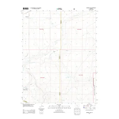
2013 Map of Snowden Lake
USGS Topo · Published 2013About this map
The Apishapa River winds through this arid landscape of Southeastern Colorado, defining a territory where water management is central to the land’s character. This map shows the transition from the Comanche National Grassland in the east into the agricultural and ranching areas of Pueblo County. Scattered water sources, such as Snowden Lake, Hixon Reservoir, and the Bull Pasture Windmill, illustrate the infrastructure required for life in this dry plains environment. The small settlements of Whiterock and Rock Crossing are linked by rural routes like Whiterock Rd and Flying A Rd. These place names, along with landmarks like Kitch Spring and La Pear Pond, offer valuable reference points for researchers interested in the legacy of high-plains ranching and the evolution of the river's path, including the distinct Old Channel Apishapa River.
Find a feature on this map
23 named features on this map. Tap any name to fly to it.
Don’t see what you’re looking for? This feature index may not catch every label — zoom into the map to look around manually.
Map Details
Editions of this 2013 Snowden Lake Map
This is the sole edition of this map. No revisions or reprints were ever made.
Other maps of this area

1891 · Timpas
USGS Topo · 1:125,000

1891 · Apishapa
USGS Topo · 1:125,000

1893 · Apishapa
USGS Topo · 1:125,000

1894 · Timpas
USGS Topo · 1:125,000

1897 · Apishapa
USGS Topo · 1:125,000

1954 · Trinidad
USGS Topo · 1:250,000

1955 · La Junta
USGS Topo · 1:250,000

1955 · Trinidad
USGS Topo · 1:250,000

1958 · La Junta
USGS Topo · 1:250,000

1958 · Trinidad
USGS Topo · 1:250,000