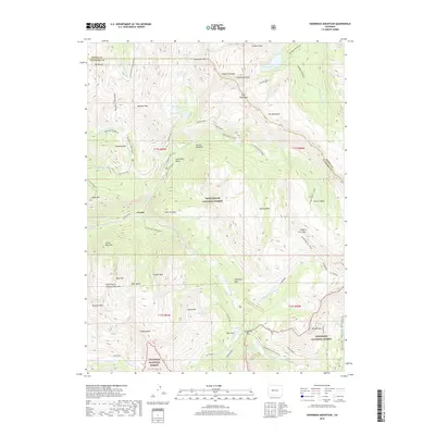
2019 Map of Snowmass Mountain
USGS Topo · Published 2019About this map
Crystal sits at the confluence of the N Fork Crystal River and the S Fork Crystal River, serving as a focal point for the high-altitude topography of the Elk Mountains. The landscape is defined by massive peaks and glacial basins, including Snowmass Mtn and Hagerman Peak, which tower over alpine waters like Snowmass Lake and Geneva Lake. This 2019 survey documents the extensive trail networks and forest boundaries within the White River National Forest and Gunnison National Forest. Evidence of the region’s mining and transit history is visible in the placement of Schofield Pass, Lead King Basin, and Mineral Point. The map also traces established routes such as Trail Riders and the Schofield Pass Ski (Snow) path, illustrating how modern recreational access follows the same steep corridors used by early explorers through Schofield Park and Elko Park.
Find a feature on this map
64 named features on this map. Tap any name to fly to it.
Don’t see what you’re looking for? This feature index may not catch every label — zoom into the map to look around manually.
Map Details
Editions of this 2019 Snowmass Mountain Map
This is the sole edition of this map. No revisions or reprints were ever made.
Other maps of this area

1888 · Crested Butte
USGS Topo · 1:62,500

1888 · Anthracite
USGS Topo · 1:62,500

1889 · Crested Butte
USGS Topo · 1:62,500

1889 · Anthracite
USGS Topo · 1:62,500

1893 · Anthracite
USGS Topo · 1:62,500

1893 · Crested Butte
USGS Topo · 1:62,500

1893 · Aspen
USGS Topo · 1:62,500

1894 · Anthracite
USGS Topo · 1:62,500

1895 · Aspen
USGS Topo · 1:62,500

1909 · Mount Jackson
USGS Topo · 1:125,000