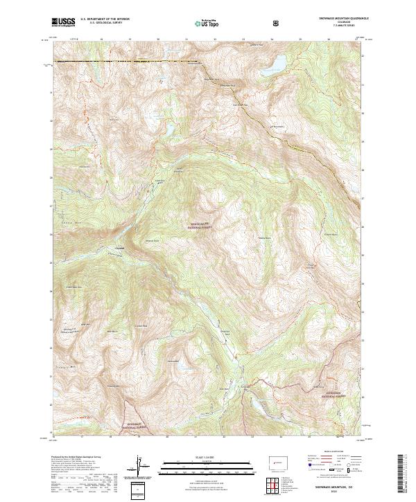
2022 Map of Snowmass Mountain
USGS Topo · Published 2022About this map
The mining-era settlement of Crystal sits at the confluence of several high-altitude forks, serving as a focal point for this survey of the high Elk Mountains. Situated within the White River National Forest and Gunnison National Forest, the landscape is defined by its extreme verticality and remote basins. High-altitude passages like Trail Rider Pass, Schofield Pass, and Frigid Air Pass connect the deep drainages of the Crystal River and Snowmass Cr, tracing the historical routes used by prospectors and early travelers. The presence of Schofield Park and Lead King Basin underscores the region's history of mineral exploration and timber management. Numerous alpine lakes, including Snowmass Lake and Geneva Lake, are scattered beneath prominent summits like Snowmass Mtn and Hagerman Peak. The intricate network of trails, such as the Maroon Snowmass Trl and Avalanche Silver Creek Trl, illustrates how this wilderness has been navigated and partitioned over decades of federal oversight.
Find a feature on this map
64 named features on this map. Tap any name to fly to it.
Don’t see what you’re looking for? This feature index may not catch every label — zoom into the map to look around manually.
Map Details
Editions of this 2022 Snowmass Mountain Map
This is the sole edition of this map. No revisions or reprints were ever made.
Other maps of this area

1888 · Crested Butte
USGS Topo · 1:62,500

1888 · Anthracite
USGS Topo · 1:62,500

1889 · Crested Butte
USGS Topo · 1:62,500

1889 · Anthracite
USGS Topo · 1:62,500

1893 · Anthracite
USGS Topo · 1:62,500

1893 · Crested Butte
USGS Topo · 1:62,500

1893 · Aspen
USGS Topo · 1:62,500

1894 · Anthracite
USGS Topo · 1:62,500

1895 · Aspen
USGS Topo · 1:62,500

1909 · Mount Jackson
USGS Topo · 1:125,000