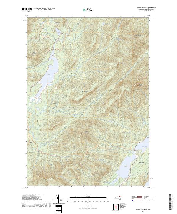
2023 Map of Snowy Mountain
USGS Topo · Published 2023About this map
Snowy Mountain and the high ridges of the Adirondacks dominate this landscape, which remains largely defined by its network of historic wilderness trails and protected water bodies. The long-established Northville-Placid Trl winds through the western terrain, passing through the Cedar River Flow and near Carry Pond. To the southeast, the village of Speculator sits at the edge of Indian Lake, serving as a primary point of entry for those navigating the mountains. The presence of the Lewey Lake Campsite Rd near Lewey Lake indicates the area's ongoing importance for backcountry recreation. Steep terrain features like Panther Mountain and Lewey Mountain overlook a complex system of drainage brooks, including Sucker Brook and Onion Brook, which feed into the larger basins of the central Hamilton County highlands.
Find a feature on this map
44 named features on this map. Tap any name to fly to it.
Don’t see what you’re looking for? This feature index may not catch every label — zoom into the map to look around manually.
Map Details
Editions of this 2023 Snowy Mountain Map
This is the sole edition of this map. No revisions or reprints were ever made.
Other maps of this area

1899 · Indian Lake
USGS Topo · 1:62,500

1900 · Canada Lake
USGS Topo · 1:62,500

1902 · Indian Lake
USGS Topo · 1:62,500

1903 · West Canada Lakes
USGS Topo · 1:62,500

1903 · Raquette Lake
USGS Topo · 1:62,500

1903 · Blue Mountain
USGS Topo · 1:62,500

1950 · Utica
USGS Topo · 1:250,000

1954 · Blue Mountain
USGS Topo · 1:62,500

1954 · Indian Lake
USGS Topo · 1:62,500

1954 · West Canada Lakes
USGS Topo · 1:62,500