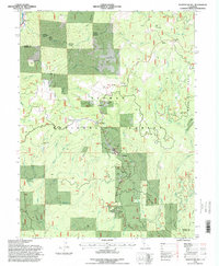
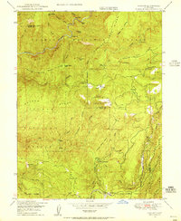
1994 Map of Soapstone Hill
USGS Topo · Published 1998About this map
The Western Pacific RR winds through the steep canyons of the North Fork Feather River in this detailed 1990s revision. The terrain is a complex network of industrial mining history and forestry management, featuring numerous named claims like the Silver Star Mine and Lucky Laddie Mine. The map highlights the transition of remote outposts, marking the former location of Merrimac (Site) and its Closed Cem, alongside seasonal infrastructure such as a Snow Hut and a Snow Survey station. Landmark peaks including Grizzly Dome and Elephant Butte overlook technical feats like the Grizzly Dome Tunnel. This survey documents a landscape balancing active resource extraction at various Quarry sites with the preservation of Plumas National Forest, providing a precise look at the Sierra Nevada's mid-elevation backcountry during the late 20th century.
Find a feature on this map
71 named features on this map. Tap any name to fly to it.
Don’t see what you’re looking for? This feature index may not catch every label — zoom into the map to look around manually.
Map Details
Editions of this 1994 Soapstone Hill Map
This is the sole edition of this map. No revisions or reprints were ever made.
Other maps of this area

1888 · Bidwell Bar
USGS Topo · 1:125,000

1891 · Bidwell Bar
USGS Topo · 1:125,000

1893 · Bidwell Bar
USGS Topo · 1:125,000

1895 · Bidwell Bar
USGS Topo · 1:125,000

1897 · Bidwell Bar
USGS Topo · 1:125,000
1947 · Brush Creek
USGS Topo · 1:24,000

1948 · Big Bend Mtn
USGS Topo · 1:62,500
1948 · Mooreville Ridge
USGS Topo · 1:62,500
1948 · Las Plumas
USGS Topo · 1:24,000
1948 · Cascade
USGS Topo · 1:24,000