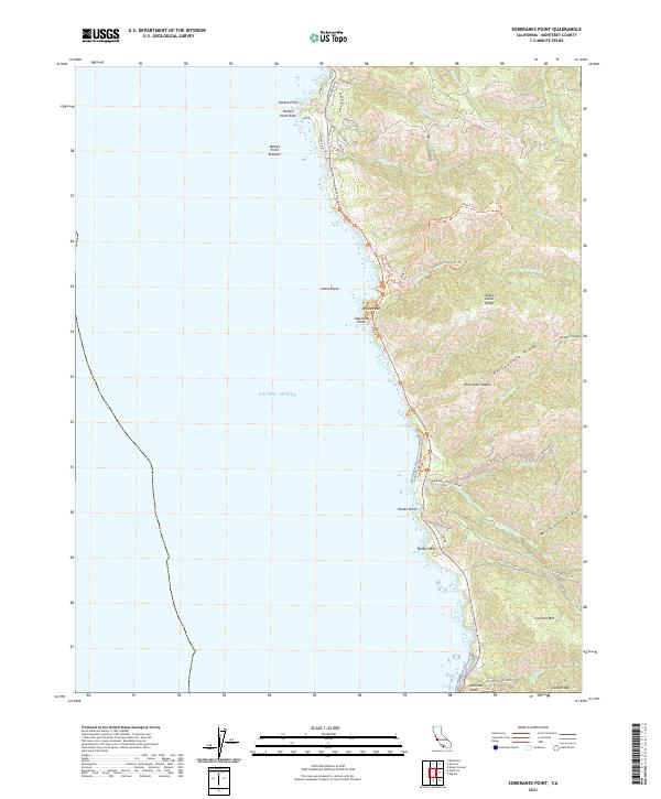
2021 Map of Soberanes Point
USGS Topo · Published 2021About this map
Soberanes Point and the steep western slopes of the Santa Lucia Range define this 2021 coastal survey of Monterey County. The landscape is marked by a series of narrow, deep canyons carved by drainages like Garrapata Cr, Malpaso Cr, and Wildcat Canyon as they descend toward the Pacific Ocean. Development is concentrated primarily near the northern coast, where a network of residential roads including Spindrift Rd and Yankee Point Dr wind around Yankee Point.
Find a feature on this map
54 named features on this map. Tap any name to fly to it.
Don’t see what you’re looking for? This feature index may not catch every label — zoom into the map to look around manually.
Map Details
Editions of this 2021 Soberanes Point Map
This is the sole edition of this map. No revisions or reprints were ever made.
Other maps of this area

1913 · Monterey
USGS Topo · 1:62,500

1918 · Point Sur
USGS Topo · 1:62,500

1925 · Point Sur
USGS Topo · 1:62,500

1941 · Monterey
USGS Topo · 1:62,500

1947 · Point Sur
USGS Topo · 1:62,500

1947 · Seaside
USGS Topo · 1:24,000

1947 · Monterey
USGS Topo · 1:62,500

1947 · Monterey
USGS Topo · 1:24,000

1948 · Santa Cruz
USGS Topo · 1:250,000
1948 · Seaside
USGS Topo · 1:24,000