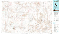
1993 Map of Soda Mountains
USGS Topo · Published 1993About this map
Fort Irwin Military Reservation and the China Lake Naval Weapons Center dominate this desert landscape, illustrating the significant military footprint in the High Mojave during the late twentieth century. Centered on the Soda Mountains, the map reveals a complex drainage system where the Mojave River terminates in the vast sinks of Soda Lake and Silver Lake. These terminal basins, along with Coyote Lake and Cronese Lake, characterize the internal drainage patterns of the region.
Find a feature on this map
47 named features on this map. Tap any name to fly to it.
Don’t see what you’re looking for? This feature index may not catch every label — zoom into the map to look around manually.
Map Details
Editions of this 1993 Soda Mountains Map
This is the sole edition of this map. No revisions or reprints were ever made.
Other maps of this area

1910 · Ivanpah
USGS Topo · 1:250,000

1912 · Ivanpah
USGS Topo · 1:250,000

1915 · Searles Lake
USGS Topo · 1:250,000

1932 · Barstow
USGS Topo · 1:125,000

1933 · Avawatz Mountains
USGS Topo · 1:250,000

1934 · Barstow
USGS Topo · 1:125,000

1942 · Ivanpah
USGS Topo · 1:250,000

1942 · Amboy
USGS Topo · 1:250,000

1943 · Amboy
USGS Topo · 1:250,000

1947 · Trona
USGS Topo · 1:250,000